
IMAGES TAKEN NEAR TO
Wimborne Road, BOURNEMOUTH, BH9 2AW
Introduction
This page details the photographs taken nearby to Wimborne Road, BH9 2AW by members of the Geograph project.
The Geograph project started in 2005 with the aim of publishing, organising and preserving representative images for every square kilometre of Great Britain, Ireland and the Isle of Man.

There are currently over 7.5m images from over14,400 individuals and you can help contribute to the project by visiting https://www.geograph.org.uk
Image Map
Images are licensed for reuse under creativecommons.org/licenses/by-sa/2.0
Notes
- Clicking on the map will re-center to the selected point.
- The higher the marker number, the further away the image location is from the centre of the postcode.
Image Listing (164 Images Found)
Images are licensed for reuse under creativecommons.org/licenses/by-sa/2.0
Image
Details
Distance
1
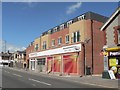
Winton: new Sainsbury?s Local
This was the BP filling station until November 2006. While the former manager took over the premises to the right, as a grocery store and newsagent, the site lay idle for a year before the new Sainsbury’s was built. It will open on 9 July 2008. I wonder if the grocery store will survive with its new neighbour.
Image: © Chris Downer
Taken: 22 Jun 2008
0.01 miles
3
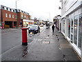
Winton: the thaw begins
A very similar view to the one here four hours earlier: Image But the postbox is no longer snow-spattered and the road no longer hazardous.
The pavement has become rather more slushy, though, and would freeze in this state later; but the roads once cleared did not freeze over in the following night.
The car, I notice, is the same one that was in the previous image so it has either outstayed the 30-minute daytime parking limit or it has returned.
Image: © Chris Downer
Taken: 6 Feb 2009
0.01 miles
4
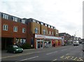
Winton, Sainsbury's Local
Opened in September 2008, on Wimborne Road.
Image: © Mike Faherty
Taken: 6 Jan 2012
0.01 miles
5
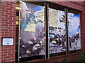
Winton: mural at Sainsbury?s
This mural was designed by students on a vocational arts course at nearby Winton Arts & Media College (formerly Winton Boys' School - see Image and is displayed by the car-park entrance of Sainsbury's (see Image; it is just to the left of the main door and is visible in Image).
Among the recognisable buildings featured are Winton Library (in the left-hand panel; see Image) and the corner piece of the Plaza, predecessor to the former Continental cinema (in the middle panel; the Continental is now occupied by Image).
Image: © Chris Downer
Taken: 16 Mar 2013
0.01 miles
6
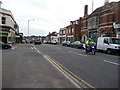
Bournemouth : Winton - Wimborne Road
I was waiting for a bus when I took this photo, possibly as a way of passing the time.
Image: © Lewis Clarke
Taken: 3 Mar 2010
0.02 miles
7
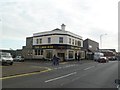
Winton, The Lark Rise
Pub on Wimborne Road, at the corner of Luther Road. Recently renamed (from The Pines) and refurbished; curving central bar, drinking and eating areas left, front, right; raised sitting areas, darts, pool, TV, jukebox, games machines. Cask ale on offer at my visit: Ringwood Best. http://www.larkrisepubbournemouth.co.uk/
Image: © Mike Faherty
Taken: 6 Jan 2012
0.02 miles
8
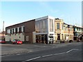
Winton: Liberal Club
Winton Liberal Club is at 521 Wimborne Road, on the corner of Calvin Road. The building site next door used to be the BP filling station, which closed in November 2006 and lay dormant for over a year before reconstruction began.
Image: © Chris Downer
Taken: 23 Mar 2008
0.03 miles
9
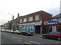
Winton, First Point
Council-operated information and resource centre on Wimborne Road, with a plaque dated 1930. http://www.bournemouth.gov.uk/SocialCareHealth/Peoplewithmentalhealthneeds/FirstPoint.aspx
Image: © Mike Faherty
Taken: 6 Jan 2012
0.03 miles
10
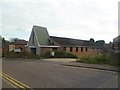
Winton URC
On Luther Road. http://www.wintonurc.org.uk/
Image: © Mike Faherty
Taken: 6 Jan 2012
0.03 miles