
IMAGES TAKEN NEAR TO
Toluca Close, BOURNEMOUTH, BH9 1FH
Introduction
This page details the photographs taken nearby to Toluca Close, BH9 1FH by members of the Geograph project.
The Geograph project started in 2005 with the aim of publishing, organising and preserving representative images for every square kilometre of Great Britain, Ireland and the Isle of Man.

There are currently over 7.5m images from over14,400 individuals and you can help contribute to the project by visiting https://www.geograph.org.uk
Image Map
Images are licensed for reuse under creativecommons.org/licenses/by-sa/2.0
Notes
- Clicking on the map will re-center to the selected point.
- The higher the marker number, the further away the image location is from the centre of the postcode.
Image Listing (146 Images Found)
Images are licensed for reuse under creativecommons.org/licenses/by-sa/2.0
Image
Details
Distance
1
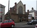
Winton: Baptist Church
Situated in Cardigan Road.
Image: © Chris Downer
Taken: 24 Feb 2008
0.03 miles
2
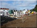
Bournemouth : Alma Road Construction Site
Image: © Lewis Clarke
Taken: 13 Feb 2009
0.06 miles
3
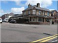
Winton: Workmen?s Club & Institute
Winton Workmen’s Club & Institute is on the corner of Parker and Trafalgar Roads.
Image: © Chris Downer
Taken: 6 Jul 2008
0.06 miles
4
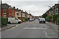
Cardigan Road, Winton
Taken just before leaving with a van-full of my daughter's stuff from the house she has been in for the last two years. Shouldn't think I'll ever be down here again!
Image: © David Lally
Taken: 7 Jul 2012
0.07 miles
5
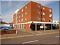
Winton: Alma Medical Centre
Until recently, I'm pretty sure this was called simply Winton Medical Centre; when the renaming took place I'm not sure. The car park sign mentions that it is for users of 'Residents and Day Centre users only' so perhaps there is no longer a clinic here.
Image: © Chris Downer
Taken: 27 Jun 2010
0.07 miles
7
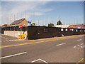
Winton: a building site of poles
This site had been redundant for a few years; I believe it was formerly a car showroom. Building work has recently started and it is just reaching the point where scaffolding shows above the cordon, but not yet the buildings.
We will see the results soon enough, I am sure.
Image: © Chris Downer
Taken: 27 Jun 2010
0.07 miles
8
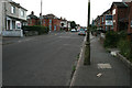
Cardigan Road, Winton
From near the eastern end of the road.
A high proportion of the houses here are now let to Students.
Image: © David Lally
Taken: 15 Aug 2010
0.08 miles
9
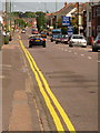
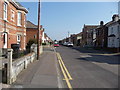
Winton: renewed yellow lines on Alma Road
This main road, part of the A3049, has recently had its double yellow lines repainted, and on such a sunny day as this they lead the eye along this mile-long straight road towards Charminster.
Taken during the England-Germany World Cup football match, this picture was never going to portray the volume of traffic normally found along Alma Road.
Image: © Chris Downer
Taken: 27 Jun 2010
0.08 miles
10
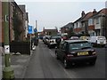
Winton: Junction Road
An unusual house numbering system exists in Junction Road – as we look along from its southern end, we see on our left numbers 1, 2 and 3; and on the right, even numbers 4, 6, 8 and 10.
On the Ordnance Survey large scale map of 1898, and when Winton was still a separate village before it became a suburb of Bournemouth, only the left-hand houses appear, so this may explain the unorthodox numbering.
Image: © Chris Downer
Taken: 24 Feb 2008
0.09 miles