
IMAGES TAKEN NEAR TO
Castle Lane West, BOURNEMOUTH, BH8 9TR
Introduction
This page details the photographs taken nearby to Castle Lane West, BH8 9TR by members of the Geograph project.
The Geograph project started in 2005 with the aim of publishing, organising and preserving representative images for every square kilometre of Great Britain, Ireland and the Isle of Man.

There are currently over 7.5m images from over14,400 individuals and you can help contribute to the project by visiting https://www.geograph.org.uk
Image Map
Images are licensed for reuse under creativecommons.org/licenses/by-sa/2.0
Notes
- Clicking on the map will re-center to the selected point.
- The higher the marker number, the further away the image location is from the centre of the postcode.
Image Listing (99 Images Found)
Images are licensed for reuse under creativecommons.org/licenses/by-sa/2.0
Image
Details
Distance
1
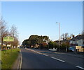
Entering Strouden Park on Castle Lane West (A3060)
Image: © JThomas
Taken: 24 Mar 2022
0.02 miles
2
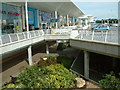
Castlepoint
This is a major new shopping centre on the outskirts of Bournemouth.
Image: © Stuart Buchan
Taken: 20 Jun 2005
0.05 miles
3
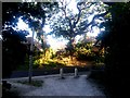
Strouden: southern end of bridleway K35
This public bridleway runs around the edge of Castlepoint shopping centre and is the diverted route of the original Valley Road, which today would cut right through the shopping complex. We see it here coming out onto Woodbury Avenue at its southern end, darkly in the shadow of the shopping complex.
This is photo 27 in a series of 28 views along Valley Road, one of the original routes in this rural part of Bournemouth. It is a public right of way, number K35, with a varied character. The northern part, from Throop Road, is a tarmacked and then gravel lane narrowing to a path onto Yeomans Way, classified as a byway open to all traffic. Its hitherto straight course once continued to the top of Woodbury Avenue near Castle Lane, but it was rerouted when the Hampshire Centre shopping complex was built in the mid-1960s and it now skirts round Castlepoint, the Hampshire Centre's successor, on a modern surface and comes out farther along Woodbury Avenue. This latter half is designated as a public bridleway. See Image for the previous photo in the series, and Image for the next.
Image: © Chris Downer
Taken: 20 Jul 2016
0.09 miles
4
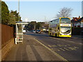
Bus stop and shelter on Castle Lane West (A3060)
Image: © JThomas
Taken: 24 Mar 2022
0.09 miles
5
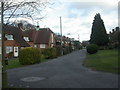
Strouden, Eventide Homes
Sheltered housing run by trust founded 1935. Land for the scheme was donated; cottages bear plaques stating who paid for them. Residents need to be over 60, live in the area or have relatives nearby, be not working & able to look after themselves. Despite its proximity to busy Castle Lane & Castlepoint, looks like an oasis of well-maintained tranquillity.
Image: © Mike Faherty
Taken: 10 Feb 2009
0.09 miles
6
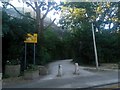
Strouden: bridleway K35 from Woodbury Avenue
This public bridleway runs around the edge of Castlepoint shopping centre and is the diverted route of the original Valley Road, which today would cut right through the shopping complex. This is its southern end, in the evening shadow of the shopping centre and with the outdoor aisles of B&Q visible in the background.
This is the last photo in a series of 28 views along Valley Road, one of the original routes in this rural part of Bournemouth. It is a public right of way, number K35, with a varied character. The northern part, from Throop Road, is a tarmacked and then gravel lane narrowing to a path onto Yeomans Way, classified as a byway open to all traffic. Its hitherto straight course once continued to the top of Woodbury Avenue near Castle Lane, but it was rerouted when the Hampshire Centre shopping complex was built in the mid-1960s and it now skirts round Castlepoint, the Hampshire Centre's successor, on a modern surface and comes out farther along Woodbury Avenue. This latter half is designated as a public bridleway. See Image for the previous photo in the series.
Image: © Chris Downer
Taken: 20 Jul 2016
0.09 miles
7
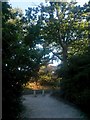
Strouden: bridleway K35 reaches Woodbury Avenue
This public bridleway runs around the edge of Castlepoint shopping centre and is the diverted route of the original Valley Road, which today would cut right through the shopping complex. We see it here as it emerges onto Woodbury Avenue at its southern end, darkly in the shadow of the shopping complex.
This is photo 26 in a series of 28 views along Valley Road, one of the original routes in this rural part of Bournemouth. It is a public right of way, number K35, with a varied character. The northern part, from Throop Road, is a tarmacked and then gravel lane narrowing to a path onto Yeomans Way, classified as a byway open to all traffic. Its hitherto straight course once continued to the top of Woodbury Avenue near Castle Lane, but it was rerouted when the Hampshire Centre shopping complex was built in the mid-1960s and it now skirts round Castlepoint, the Hampshire Centre's successor, on a modern surface and comes out farther along Woodbury Avenue. This latter half is designated as a public bridleway. See Image for the previous photo in the series, and Image for the next.
Image: © Chris Downer
Taken: 20 Jul 2016
0.09 miles
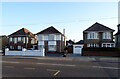
9
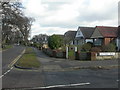
Strouden, Woodbury Avenue
Look quickly, and you would think they were bungalows, but most have dormers. Note different pitched roofs.
Image: © Mike Faherty
Taken: 10 Feb 2009
0.11 miles
10
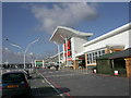
Castlepoint, East wing
Castlepoint was one of the last out-of-town retail parks to be allowed by the government. Here, the East wing, looking towards the focal point at M&S; the green sign in between is ASDA. Other household names also represented. For further details, see http://www.castlepointshopping.com/
Image: © Mike Faherty
Taken: 10 Feb 2009
0.11 miles