
IMAGES TAKEN NEAR TO
Castle Way, BOURNEMOUTH, BH8 9TA
Introduction
This page details the photographs taken nearby to Castle Way, BH8 9TA by members of the Geograph project.
The Geograph project started in 2005 with the aim of publishing, organising and preserving representative images for every square kilometre of Great Britain, Ireland and the Isle of Man.

There are currently over 7.5m images from over14,400 individuals and you can help contribute to the project by visiting https://www.geograph.org.uk
Image Map
Images are licensed for reuse under creativecommons.org/licenses/by-sa/2.0
Notes
- Clicking on the map will re-center to the selected point.
- The higher the marker number, the further away the image location is from the centre of the postcode.
Image Listing (119 Images Found)
Images are licensed for reuse under creativecommons.org/licenses/by-sa/2.0
Image
Details
Distance
1
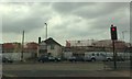
House defiant amid development
The photo tells its own story. The residents of the central house refused to sell out to developers, with the result that the new houses are being built around it. (Eventually a few years later, the development was completed).
Image: © Jonathan Hutchins
Taken: 5 May 2010
0.00 miles
2
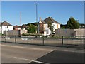
Strouden: the forgotten house
Situated at 420 Castle Lane West, this house's neighbours have all been demolished to make way for a retail park, enlargement of the major roundabout here, and a small housing estate to the left. It seems the only fate that can be on the horizon is demolition; perhaps the only reason it survived was because it was used by workmen during all the building work.
Image: © Chris Downer
Taken: 22 Jun 2008
0.01 miles
3
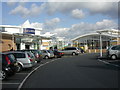
Castlepoint, West Village
Visually confusing, and stretching the concept of "village" to its extreme. For details, see http://www.castlepointshopping.com/Facilities.html
Image: © Mike Faherty
Taken: 10 Feb 2009
0.04 miles
4
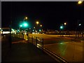
Strouden: so many green lights, but nothing to go
Mallard Road Roundabout is very busy during the daytime, being on the important Castle Lane West and at one of the two accesses to Castlepoint shopping centre. The myriad traffic lights keep things moving as much as possible – when sat at a red light, it seems odd that nothing is crossing your path, but of course the lane has to be kept clear for anything wishing to turn right across your path even if nothing does; otherwise, anything held up on the roundabout itself would soon cause a complete logjam.
However, at night, the sequence continues even if traffic levels are light. Here we see no fewer than eleven green lights shining in favour of eastbound traffic on Castle Lane – plus a twelfth, far left, at a pedestrian crossing in Yeomans Road and some distant ones at another crossing. But there is no traffic to take advantage of the signal to proceed. Meanwhile, westbound traffic waits on red for the nothing to pass.
Image: © Chris Downer
Taken: 16 Jul 2009
0.05 miles
5
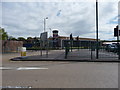
Bournemouth : Mallard Road Junction
Homebase can be seen behind the junction.
Image: © Lewis Clarke
Taken: 27 Apr 2009
0.05 miles
7
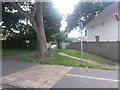
Strouden: footpath K19 to Curlew Road
This driveway to rear garages forms a public footpath to Curlew Road. It is motorable throughout but not as a through route as there are bollards halfway along. See Image for the next picture along the path.
Image: © Chris Downer
Taken: 25 Jun 2016
0.06 miles
8
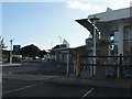
Strouden: West Village, Castlepoint
At the front of Castlepoint shopping centre are two small retail areas, West and East Village. This one comprises Jessop's and Lakeland.
Image: © Chris Downer
Taken: 22 Jun 2008
0.06 miles
9
Bournemouth : Lakeland, Sainsbury's & Yeomans Road
Image: © Lewis Clarke
Taken: 27 Apr 2009
0.06 miles
10
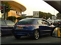
Strouden: new car leaving Castlepoint
A quick opportunistic snap of a '60' registration plate on its first day of issue, while waiting for the lights to change.
The current registration system sees the two-digit year being issued from 1 March to 31 August, and the two-digit year +50 issued from 1 September to the following 28 (or 29) February. The first such issue was on 1 September 2001 - thus a '51' plate (and coincidentally England's football team beat Germany on that day by the score of 5-1). The system has the capacity to remain in force until 2050, when the components could be reversed and it could go for another 50 years. The first two letters denote the area (H is for Hampshire & Dorset with the first part of the alphabet in second position the more usual seen in this area), while the last three letters are random.
Here, the car is turning left out of Hamblin Way (named after a local man of eminence in the medical field, Dr. Terry Hamblin) which is the main road through the Castlepoint shopping centre. It is taking the most usual route out, with the main A3060 at the roundabout ahead, whose signage we see in the background. Traffic turning right, such as me, are going to the modern northern suburbs of town. The bus behind me, just visible in my wing mirror, is not in service but is bound for the bus depot which is in Yeomans Way, behind the shopping centre.
Image: © Chris Downer
Taken: 1 Sep 2010
0.06 miles