
IMAGES TAKEN NEAR TO
East Way, BOURNEMOUTH, BH8 9PS
Introduction
This page details the photographs taken nearby to East Way, BH8 9PS by members of the Geograph project.
The Geograph project started in 2005 with the aim of publishing, organising and preserving representative images for every square kilometre of Great Britain, Ireland and the Isle of Man.

There are currently over 7.5m images from over14,400 individuals and you can help contribute to the project by visiting https://www.geograph.org.uk
Image Map
Images are licensed for reuse under creativecommons.org/licenses/by-sa/2.0
Notes
- Clicking on the map will re-center to the selected point.
- The higher the marker number, the further away the image location is from the centre of the postcode.
Image Listing (90 Images Found)
Images are licensed for reuse under creativecommons.org/licenses/by-sa/2.0
Image
Details
Distance
1

Strouden: footpaths K09 and K10 meet
Public footpath K09 runs along the frontages of odd-numbered houses in Mallard Road, alongside the green space which separates them from Mallard Road itself (far right).
Meanwhile, a few paved paths cross the green, such as footpath K10 which we see just in front of us (see Image for the full 24m length of that path).
See Image for the next view on path K09 ahead, and Image for the next view on the path behind us - each with links to further photos on this and adjoining routes.
Image: © Chris Downer
Taken: 11 Feb 2017
0.03 miles
2

Strouden: footpaths K09 and K14 meet
Public footpath K09 runs along the frontages of odd-numbered houses in Mallard Road, alongside the green space which separates them from Mallard Road itself (extreme left).
Meanwhile, a few paved paths cross the green, such as footpath K14 which we see just in front of us (see Image for the full 13m length of that path).
See Image for the next view on path K09 ahead, and Image for the next view on the path behind us - each with links to further photos on this and adjoining routes.
Image: © Chris Downer
Taken: 11 Feb 2017
0.03 miles
3

Strouden: footpath K09 passes in front of odd-numbered houses
This public footpath follows the frontages of odd numbers in Mallard Road; these houses face a substantial open space which gradually widens to the far end. The carriageway of Mallard Road is just out of picture to the left but the pavement can just be seen at the extreme left-hand edge.
See Image] for the view of the path behind us, and Image for the next view ahead - each with links to further photos on this and adjoining routes.
Image: © Chris Downer
Taken: 11 Feb 2017
0.03 miles
4

Strouden: footpath K10 from Mallard Road
The middle one of the three public footpaths which cross the open space between the carriageway and the houses of Mallard Road. (The path in the foreground is the pavement; the road is immediately behind us.) The shape of the green gently narrows so the other two paths are one longer and one shorter. See Image for a side-on view of the path.
For the other two paths mentioned, see:
Image
Image
Meanwhile, the path along the frontages of the houses is footpath K09 (see Image).
Image: © Chris Downer
Taken: 25 Jun 2016
0.04 miles
5
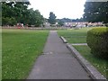
Strouden: footpath K09 reaches the play park
A view from the end of the terrace shown in Image, we look towards the end of the public footpath as it reaches the play park on the open space which has gradually widened out as we have walked along here.
See Image for a view back this way from the end of the path (I should say, the end of the public right of way; the actual path continues around the play park and onto Seagull Road by the tree centre-picture. This is shown as a right of way on some older maps, but no longer - although the tree marks the start of another public footpath - see Image)
See Image for the next view on the path behind us, with links to further photos along that direction of the route.
Image: © Chris Downer
Taken: 25 Jun 2016
0.04 miles
6

Strouden: footpath K09 from its southern end
Looking along the funnel-shaped green space between the houses and the carriageway of Mallard Road, the opposite view to Image
See also Image for a footpath to our right, one of three that run directly across the green between the houses and the road, taken from this same spot.
Image: © Chris Downer
Taken: 25 Jun 2016
0.04 miles
7

Strouden: footpath K11 to Mallard Road
One of two parallel public footpaths between East Way and Mallard Road, separated by a small block of flats just to our left. See Image] for the other and Image] for a view of both path entrances in the same view.
The public right of way actually stops a few yards short of Mallard Road, as a small garage access driveway takes over.
See Image for a view of the path from the other end.
Image: © Chris Downer
Taken: 25 Jun 2016
0.04 miles
8

Strouden: footpath K11 to East Way
One of two parallel public footpaths between Mallard Road and East Way - see Image for a view from the other end along with further notes.
Image: © Chris Downer
Taken: 25 Jun 2016
0.04 miles
9

Strouden: footpath K14 from Mallard Road
One of the three public footpaths which cross the open space between the carriageway and the houses of Mallard Road. (The path in the foreground is the pavement; the road is immediately to the right.) The shape of the green gragually widens so the other two paths are longer.
For the other two paths mentioned, see:
Image
Image
See Image for path K09 as it passes the far end of this path.
Image: © Chris Downer
Taken: 25 Jun 2016
0.04 miles
10
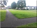
Strouden: footpath K07 from Mallard Road
One of the three public footpaths which cross the open space between the carriageway and the houses of Mallard Road. (The path in the foreground is the pavement; the road is immediately behind us.) The green, as it heads to our right, gently narrows so the other paths are rather shorter.
See Image for a view of this path from the far end and Image for a wider view from behind us.
For the other two paths mentioned, see:
Image
Image
Meanwhile, the path along the frontages of the houses, starting at the end of this one, is footpath K09 (see Image).
Image: © Chris Downer
Taken: 25 Jun 2016
0.05 miles