
IMAGES TAKEN NEAR TO
Parkway Drive, BOURNEMOUTH, BH8 9JP
Introduction
This page details the photographs taken nearby to Parkway Drive, BH8 9JP by members of the Geograph project.
The Geograph project started in 2005 with the aim of publishing, organising and preserving representative images for every square kilometre of Great Britain, Ireland and the Isle of Man.

There are currently over 7.5m images from over14,400 individuals and you can help contribute to the project by visiting https://www.geograph.org.uk
Image Map
Images are licensed for reuse under creativecommons.org/licenses/by-sa/2.0
Notes
- Clicking on the map will re-center to the selected point.
- The higher the marker number, the further away the image location is from the centre of the postcode.
Image Listing (44 Images Found)
Images are licensed for reuse under creativecommons.org/licenses/by-sa/2.0
Image
Details
Distance
1
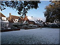
Queen?s Park: snow scene in Queen?s Park Avenue
The wide verge between the pavement and carriageway of Queen's Park Avenue, seen after snowfall overnight. The upmarket houses of the area look on.
Image: © Chris Downer
Taken: 18 Dec 2010
0.08 miles
2
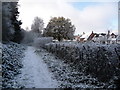
Queen?s Park: park?s peripheral path
This image seems to have a cold main bit with a more colourful backdrop - after heavyish snow today's sun cannot reach the foreground because of the tall trees along this part of the northern edge of the golf course. It is reaching the houses of Queen's Park Avenue, though, in the background.
Image: © Chris Downer
Taken: 18 Dec 2010
0.10 miles
3
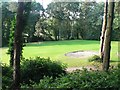
Queen?s Park: fourth green
A view over the fourth green from the wooded area alongside.
Image: © Chris Downer
Taken: 22 Jun 2008
0.11 miles
4
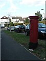
Strouden: postbox № BH8 172, Feversham Avenue
This postbox stands outside a former parade of shops which gradually became vacated until the inevitable happened and they were converted, rather smartly it has to be said, to residential use.
Image: © Chris Downer
Taken: 22 Jul 2008
0.11 miles
5
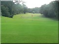
Queen?s Park: the fourth
Looking down the fourth hole of Queen’s Park golf course; this hole runs alongside Queen’s Park Avenue, which is behind the trees to the right.
Image: © Chris Downer
Taken: 22 Jun 2008
0.12 miles
6
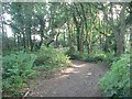
Queen?s Park: path through woods
This path through a wooded section between two fairways, is the route from the sixth hole to the seventh tee.
Image: © Chris Downer
Taken: 22 Jun 2008
0.12 miles
7
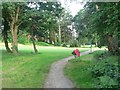
Queen?s Park: foot of Longman?s Bottom path
See Image for more details of this ancient track which goes through what is now Queen’s Park golf club. Here, we are looking up the path from its end on Queen’s Park Avenue.
Image: © Chris Downer
Taken: 22 Jun 2008
0.12 miles
8
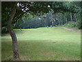
Queen's Park, Bournemouth
The golf course Queen's Park.
Queen's Park remains primarily a Park, despite attempts made by the town council in 2001 to fence it off and effectively privatise it as a golf course. They failed in part because the governing Trust won't allow it. A local society, QPIPS, has since been working hard to re-diversify the Park's use and encourage informal recreation and wildlife.
Image: © Stuart Buchan
Taken: 1 Aug 2005
0.14 miles
9
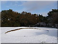
Queen?s Park: bunker in the snow
Looking across to what I believe is the sixth green of the Queen's Park golf course, after substantial overnight snow.
Image: © Chris Downer
Taken: 18 Dec 2010
0.15 miles
10
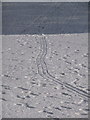
Queen?s Park: sledge tracks in the snow
Last night's snowfall and the undulating nature of Queen's Park golf course provided ideal conditions for taking a sledge, or all manner of household items masquerading as a sledge, and enjoying childish fun whatever your age. A sledge has been dragged here along the seventh fairway towards a favourite slope.
Image: © Chris Downer
Taken: 18 Dec 2010
0.15 miles