
IMAGES TAKEN NEAR TO
Cecil Avenue, BOURNEMOUTH, BH8 9EL
Introduction
This page details the photographs taken nearby to Cecil Avenue, BH8 9EL by members of the Geograph project.
The Geograph project started in 2005 with the aim of publishing, organising and preserving representative images for every square kilometre of Great Britain, Ireland and the Isle of Man.

There are currently over 7.5m images from over14,400 individuals and you can help contribute to the project by visiting https://www.geograph.org.uk
Image Map
Images are licensed for reuse under creativecommons.org/licenses/by-sa/2.0
Notes
- Clicking on the map will re-center to the selected point.
- The higher the marker number, the further away the image location is from the centre of the postcode.
Image Listing (43 Images Found)
Images are licensed for reuse under creativecommons.org/licenses/by-sa/2.0
Image
Details
Distance
1
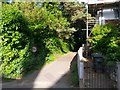
Charminster: footpath K03 to Burnham Drive
This broad public footpath leads between two houses in Howard Road to the dead end of Burnham Drive.
See Image for the view towards us from ahead, and links to further photos along the route.
Image: © Chris Downer
Taken: 13 Jul 2016
0.05 miles
2
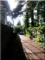
Charminster: footpath K03 approaches Howard Road
This public footpath approaches its western end, the reciprocal view to Image
See Image for the next view behind us on the path, and links to further photos along the route.
Image: © Chris Downer
Taken: 13 Jul 2016
0.05 miles
3
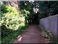
Charminster: footpath K03 heads around a bend
This public footpath leads from Howard Road to Burnham Drive, and does a shallow left-hand bend just ahead of us, passing the backs of the back gardens of the adjoining properties before running alongside a small wooded patch.
See Image for the next view along the path ahead, and Image for the next view behind.
Image: © Chris Downer
Taken: 13 Jul 2016
0.08 miles
4
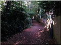
Charminster: footpath K03 straightens out
Looking along this public footpath to Burnham Drive as it completes the bend shown in Image
The view towards us from a good way ahead can be seen here: Image
Image: © Chris Downer
Taken: 13 Jul 2016
0.09 miles
5
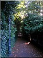
Charminster: long straight on footpath K03
This public footpath heads for Howard Road from the top end of Burnham Drive - the majority of the route is on this long straight route before turning a bend shortly before arrival at the other end.
See Image for the view towards us from the distant bend, and Image for the emergence onto Burnham Drive behind us.
Image: © Chris Downer
Taken: 13 Jul 2016
0.09 miles
6
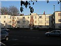
Charminster: Cecil Court
An attractive block of 24 flats in Charminster Road.
Image: © Chris Downer
Taken: 14 Apr 2008
0.09 miles
7
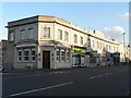
Charminster: Queen?s Park Terrace
A smart parade of shops, nos. 360-372 Charminster Road. See Image for detail of the lettering.
Image: © Chris Downer
Taken: 14 Apr 2008
0.10 miles
8
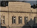
Charminster: Queen?s Park Terrace (detail)
Detail of the lettering in the central façade of Image
Image: © Chris Downer
Taken: 14 Apr 2008
0.10 miles
9
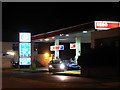
Charminster: petrol back under a pound
A year almost to the day since I last bought petrol for less than a pound a litre, and having peaked at about 113p it has returned to two digits.
Image: © Chris Downer
Taken: 27 Oct 2008
0.10 miles
10
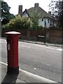
Queen?s Park: postbox № BH8 167, Howard Road
An Edward VII-reign postbox on the corner of Howard Road and St. Alban's Avenue.
Image: © Chris Downer
Taken: 26 Jun 2008
0.11 miles