
IMAGES TAKEN NEAR TO
Richmond Park Road, BOURNEMOUTH, BH8 8TP
Introduction
This page details the photographs taken nearby to Richmond Park Road, BH8 8TP by members of the Geograph project.
The Geograph project started in 2005 with the aim of publishing, organising and preserving representative images for every square kilometre of Great Britain, Ireland and the Isle of Man.

There are currently over 7.5m images from over14,400 individuals and you can help contribute to the project by visiting https://www.geograph.org.uk
Image Map
Images are licensed for reuse under creativecommons.org/licenses/by-sa/2.0
Notes
- Clicking on the map will re-center to the selected point.
- The higher the marker number, the further away the image location is from the centre of the postcode.
Image Listing (45 Images Found)
Images are licensed for reuse under creativecommons.org/licenses/by-sa/2.0
Image
Details
Distance
1
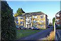
136 Richmond Park Road
A block of flats called Warwick Court.
Image: © Robin Webster
Taken: 25 Nov 2016
0.01 miles
2
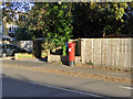
Postbox BH8 72D
A Victorian model on Howard Road.
Image: © Robin Webster
Taken: 25 Nov 2016
0.06 miles
3
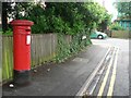
Queen?s Park: postbox № BH8 72, Howard Road
A Victorian specimen at the southern end of Howard Road.
Image: © Chris Downer
Taken: 6 Jul 2008
0.07 miles
4
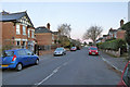
Richmond Wood Road, Bournemouth
One of many similar residential streets here.
Image: © Robin Webster
Taken: 25 Nov 2016
0.11 miles
5
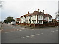
Richmond Park Avenue, Queen's Park, Bournemouth
Richmond Park Avenue is a residential road in the Queen's Park district of Bournemouth.
Image: © Malc McDonald
Taken: 7 Feb 2022
0.11 miles
6
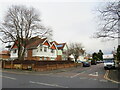
Richmond Park Avenue, Queen's Park, Bournemouth
Richmond Park Avenue is a residential road in the Queen's Park district of Bournemouth.
This image was taken in early February. Trees were bare for the winter months.
Image: © Malc McDonald
Taken: 7 Feb 2022
0.12 miles
7
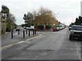
Charminster: Capstone and Chatsworth Roads
Chatsworth Road (left) meets Capstone Road at this acute junction. It is only in recent years that the corner has been sharpened, before which the left-hand kerbstones continued in a straight line to the foreground, as can still be seen.
Image: © Chris Downer
Taken: 1 Jan 2008
0.12 miles
8
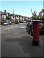
Charminster: postbox № BH8 164, Chatsworth Road
This Edward VII-reign postbox is at the western end of Chatsworth Road: see (Image).
Image: © Chris Downer
Taken: 19 Jul 2008
0.12 miles
9

Malmesbury Park: Capstone Road
Malmesbury Park, named after a one-time landowner in the area – the Earl of Malmesbury, consists of a number of long straight roads like this one, with similar detached houses on either side. St. Leonard's Road crosses them all, and this is the crossroads.
Image: © Chris Downer
Taken: 1 Jan 2008
0.12 miles
10
Chatsworth Road
Showing position of Postbox No. BH8 164.
Image: © JThomas
Taken: 23 Mar 2022
0.13 miles