
IMAGES TAKEN NEAR TO
Wellington Road, BOURNEMOUTH, BH8 8LD
Introduction
This page details the photographs taken nearby to Wellington Road, BH8 8LD by members of the Geograph project.
The Geograph project started in 2005 with the aim of publishing, organising and preserving representative images for every square kilometre of Great Britain, Ireland and the Isle of Man.

There are currently over 7.5m images from over14,400 individuals and you can help contribute to the project by visiting https://www.geograph.org.uk
Image Map
Images are licensed for reuse under creativecommons.org/licenses/by-sa/2.0
Notes
- Clicking on the map will re-center to the selected point.
- The higher the marker number, the further away the image location is from the centre of the postcode.
Image Listing (64 Images Found)
Images are licensed for reuse under creativecommons.org/licenses/by-sa/2.0
Image
Details
Distance
1
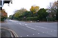
Wellington Rd Bournemouth
The view NW up Wellington Rd close to its junction with Beechey Rd just NW of the towns railway station.
Image: © Nigel Mykura
Taken: 4 Nov 2008
0.05 miles
2

Bournemouth: ambulance station garages
A view along the rear driveway of Dorset Ambulance NHS Trust headquarters, at a line of ambulance bonnets.
Image: © Chris Downer
Taken: 10 Jul 2008
0.06 miles
3

The line from Beechey Road bridge
Running northwest and on towards Branksome station.
Image: © Neil Owen
Taken: 7 Sep 2021
0.08 miles
4
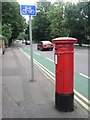
Bournemouth: postbox № BH8 86, Wellington Road
Looking east along Wellington Road past this Victorian postbox.
Image: © Chris Downer
Taken: 10 Jul 2008
0.08 miles
5

High voltage cable sign on Beechey Road
An old cast iron sign warns of the presence of some high tension lines on the bridge that crosses the railway below. Presumably S.E.B. stands for Southern Electricity Board.
Image: © Neil Owen
Taken: 7 Sep 2021
0.09 miles
6
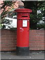
Bournemouth: postbox № BH1 43, Beechey Road
This postbox in Beechey Road has no cipher giving the reign in which it was made. These were manufactured between 1879 and 1887 so, despite the anonymity, it is Victorian.
Image: © Chris Downer
Taken: 31 May 2008
0.10 miles
8
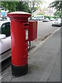
Malmesbury Park: postbox № BH8 151, Portchester Road
An Edward VII-reign box, with the ambulance station in the background.
Image: © Chris Downer
Taken: 10 Jul 2008
0.12 miles
9
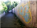
Malmesbury Park: graffiti on footpath C16
A colourful but mindless adornment to this public footpath between Milton and Lowther Roads.
See Image] for the view towards us from the end, and Image for the next photo along the path behind us.
Image: © Chris Downer
Taken: 3 Jul 2016
0.13 miles
10
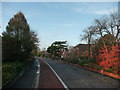
Bournemouth : Lansdowne Road
An autumn scene, with the red looking leaves in Bournemouth.
Image: © Lewis Clarke
Taken: 20 Nov 2009
0.13 miles