
IMAGES TAKEN NEAR TO
Shawford Road, BOURNEMOUTH, BH8 0PD
Introduction
This page details the photographs taken nearby to Shawford Road, BH8 0PD by members of the Geograph project.
The Geograph project started in 2005 with the aim of publishing, organising and preserving representative images for every square kilometre of Great Britain, Ireland and the Isle of Man.

There are currently over 7.5m images from over14,400 individuals and you can help contribute to the project by visiting https://www.geograph.org.uk
Image Map
Images are licensed for reuse under creativecommons.org/licenses/by-sa/2.0
Notes
- Clicking on the map will re-center to the selected point.
- The higher the marker number, the further away the image location is from the centre of the postcode.
Image Listing (36 Images Found)
Images are licensed for reuse under creativecommons.org/licenses/by-sa/2.0
Image
Details
Distance
1
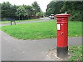
Throop: postbox № BH8 70, Chesildene Drive
This Victorian postbox certainly hasn't been in this position since it was manufactured! This is a 1980s housing estate, before which this area was just farmland.
Image: © Chris Downer
Taken: 18 Jul 2008
0.06 miles
2
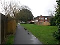
Throop: byway K23 reaches Chesildene Avneue
This straight path, along with the modern-day stretch of road continuing eventually behind us, was one of the original tracks when Throop was a rural area. In the 1980s the vast housing estate was built and the first stretch of Chesildene Drive was borrowed, but it then swings around to the north while still carrying the name. Ahead, it approaches the other end, on a modern cul-de-sac named Chesildene Avenue, where again the original route used to extend to the junction visible in the very background.
The path is still designated as a public right of way - a byway open to all traffic (or B.O.A.T.), number K23, although its extent has been truncated at both ends as described above.
See Image for a view towards us from the road ahead, and Image for the next view on the path behind us, with links to further photos along the path.
Image: © Chris Downer
Taken: 5 Mar 2017
0.11 miles
3
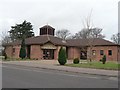
Throop: church of St. Paul
A modern church on this modern (1980s) housing estate.
Image: © Chris Downer
Taken: 3 Feb 2008
0.11 miles
4
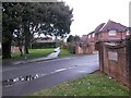
Throop: byway K23 from Chesildene Avenue
This straight path, along with the modern-day stretch of road continuing at the far end, was one of the original tracks when Throop was a rural area. In the 1980s the vast housing estate was built and the first stretch of Chesildene Drive was borrowed, but it then swings around to the north while still carrying the name. Just here we look at it actually from Chesilbourne Grove, a cul-de-sac off Chesildene Avenue which is just to our left, and similarly continues behind us a short way on the original course of the track.
The path is still designated as a public right of way - a byway open to all traffic (or B.O.A.T.), number K23, although its extent has been truncated at both ends as described above.
See Image for the next view on the path ahead, with links to further photos along the path.
Image: © Chris Downer
Taken: 5 Mar 2017
0.12 miles
5
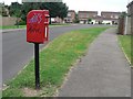
Throop: postbox № BH8 176, Landford Way
While roads in the similar 80s housing estate to the west of Broadway Lane are named after Dorset villages, this estate's roads are named after west Hampshire villages – this is Landford Way and in the distance is the junction with Tytherley Green (named after West and East Tytherley).
Image: © Chris Downer
Taken: 18 Jul 2008
0.14 miles
6
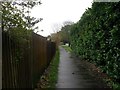
Throop: byway K23 nears its eastern end
This straight path, along with the modern-day stretch of road continuing eventually behind us, was one of the original tracks when Throop was a rural area. In the 1980s the vast housing estate was built and the first stretch of Chesildene Drive was borrowed, but it then swings around to the north while still carrying the name. Ahead, it approaches the other end, on a modern cul-de-sac named Chesildene Avenue.
The path is still designated as a public right of way - a byway open to all traffic (or B.O.A.T.), number K23, although its extent has been truncated at both ends.
See Image for the next view on the path behind us, and Image for the next view ahead - each with links to further photos along the path.
Image: © Chris Downer
Taken: 5 Mar 2017
0.15 miles
7

Muscliff: Mill Road (North) from Cadnam Way
Looking along Mill Road (North), which forms byway open to all traffic (or B.O.A.T.) number K22, from its southern end. It is a historical route pre-dating the modern 1980s housing estate here, and it used to extend along Mill Road (South) behind us, before the latter segment was incorporated into the modern housing estate as part of the public highway. The route can still be eminently followed on its dead-straight course behind us, although the estate roads curve across the route.
See Image for the next view along the road ahead, with links to further pictures along the route.
Image: © Chris Downer
Taken: 16 Jul 2016
0.16 miles
8
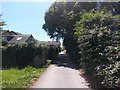
Muscliff: Mill Road (North) nears the modern estate
Looking south along Mill Road (North), which forms byway open to all traffic (or B.O.A.T.) number K22 - it used to extend along Mill Road (South) to Castle Lane before the latter segment was incorporated into the modern housing estate as part of the public highway (its course can be followed dead-straight ahead although the modern estate roads curve somewhat).
To our left are the backs of houses on Broadlands Close, at the northern edge of the vast Muscliff housing estate.
See Image for the view along here from the end ahead, and Image for the next view on the road behind us.
Image: © Chris Downer
Taken: 16 Jul 2016
0.17 miles
9
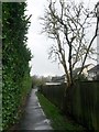
Throop: passing a spindly tree on byway K23
This straight path, along with the modern-day stretch of road continuing eventually ahead, was one of the original tracks when Throop was a rural area. In the 1980s the vast housing estate was built and the first stretch of Chesildene Drive was borrowed, but it then swings around to the north while still carrying the name.
The path is still designated as a public right of way - a byway open to all traffic (or B.O.A.T.), number K23, although its extent has been truncated at both ends.
See Image for the next view on the path ahead, and Image for the next view behind us - each with links to further photos along the path.
Image: © Chris Downer
Taken: 5 Mar 2017
0.18 miles
10
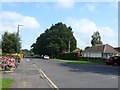
Mill Rd Charminster, Bournemouth
Looking north from the A3060
Image: © Nigel Mykura
Taken: 13 Sep 2008
0.18 miles