
IMAGES TAKEN NEAR TO
Glenferness Avenue, BH4 9NP
Introduction
This page details the photographs taken nearby to Glenferness Avenue, BH4 9NP by members of the Geograph project.
The Geograph project started in 2005 with the aim of publishing, organising and preserving representative images for every square kilometre of Great Britain, Ireland and the Isle of Man.

There are currently over 7.5m images from over14,400 individuals and you can help contribute to the project by visiting https://www.geograph.org.uk
Image Map
Images are licensed for reuse under creativecommons.org/licenses/by-sa/2.0
Notes
- Clicking on the map will re-center to the selected point.
- The higher the marker number, the further away the image location is from the centre of the postcode.
Image Listing (50 Images Found)
Images are licensed for reuse under creativecommons.org/licenses/by-sa/2.0
Image
Details
Distance
1
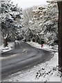
Talbot Woods: Glenferness Avenue in snow
Looking along this busy but unclassified commuter route through the upmarket suburb of Talbot Woods. It is not so busy today, after Bournemouth's heaviest snow for 17 years fell overnight. The postbox on the corner of Elgin Road adds a splash of colour to the resultant monochrome scene.
Image: © Chris Downer
Taken: 2 Dec 2010
0.03 miles
2
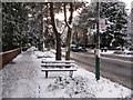
Talbot Woods: bus stop in Glenferness Avenue
Two minor bus routes stop here, the more minor routes colour coded orange on bus stop signs. There have been no buttocks deployed on this bench today, though - and I'm not sure that these buses would have been running today, after Bournemouth's heaviest snow for 17 years fell overnight.
Image: © Chris Downer
Taken: 2 Dec 2010
0.05 miles
4
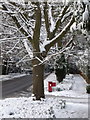
Talbot Woods: tree and postbox in Glenferness Avenue
A wintry scene after Bournemouth's heaviest snow for 17 years fell overnight. Not as noticeable as the postbox, the chevron to the far left is not there because of a bend in the road, but because the road narrows at the railway bridge which is immediately behind the tree.
Image: © Chris Downer
Taken: 2 Dec 2010
0.06 miles
5
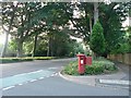
Talbot Woods: postbox № BH4 256, Glenferness Avenue
This postbox is on Glenferness Avenue, by the junction with Elgin Road. Ahead, we see where Glenferness Avenue narrows from its considerable width for the duration of the railway bridge. All but the historical thoroughfares in Talbot Woods are named after Scottish places, such as these two.
Image: © Chris Downer
Taken: 2 Jul 2008
0.06 miles
6
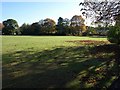
Playing field, Rothesay Road
Early autumn on the eastern side of the recreation ground bordering Rothesay Road south of the railway line. The other side of the road is occupied by large houses mainly of the 1920s. The sites of two round barrows lie on this space.
Image: © Derek Harper
Taken: 12 Oct 2009
0.07 miles
7
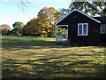
Pavilion, Rothesay Road
The wooden pavilion in the southern corner of Image
Image: © Derek Harper
Taken: 12 Oct 2009
0.08 miles
8
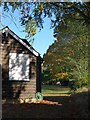
Pavilion, Rothesay Road (2)
Another view of Image, looking along the edge of the playing fields.
Image: © Derek Harper
Taken: 12 Oct 2009
0.08 miles
9
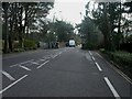
Bournemouth, Glenferness Avenue bridge
Bridge taking traffic over the Bournemouth-Poole railway line. The line opened in 1888; this bridge probably dates from then. To the left is a separate bridge for pedestrians.
Image: © Mike Faherty
Taken: 22 Feb 2009
0.10 miles
10
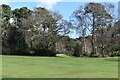
Western end of the golf course in Meyrick Park
Image: © David Martin
Taken: 3 Mar 2024
0.13 miles