
IMAGES TAKEN NEAR TO
Glenferness Avenue, BOURNEMOUTH, BH4 9NB
Introduction
This page details the photographs taken nearby to Glenferness Avenue, BH4 9NB by members of the Geograph project.
The Geograph project started in 2005 with the aim of publishing, organising and preserving representative images for every square kilometre of Great Britain, Ireland and the Isle of Man.

There are currently over 7.5m images from over14,400 individuals and you can help contribute to the project by visiting https://www.geograph.org.uk
Image Map
Images are licensed for reuse under creativecommons.org/licenses/by-sa/2.0
Notes
- Clicking on the map will re-center to the selected point.
- The higher the marker number, the further away the image location is from the centre of the postcode.
Image Listing (112 Images Found)
Images are licensed for reuse under creativecommons.org/licenses/by-sa/2.0
Image
Details
Distance
1
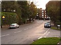
Talbot Woods: bottom end of Glenferness Avenue
Looking down Glenferness Avenue past the junction of Branksome Hill Road. In the distance, motorists can turn – into Branksome Wood Road – either left towards the town centre or right towards Poole.
Image: © Chris Downer
Taken: 6 Dec 2009
0.02 miles
2
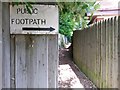
Talbot Woods: footpath A13 is pointed out
A short distance along Image this little sign marks the course of the path, although it's pretty obvious if you've made it this far. The path leads to Image
See Image for the next view along the path.
Image: © Chris Downer
Taken: 28 Jun 2016
0.04 miles
3
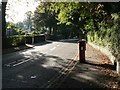
Bournemouth: postbox № BH4 37, Branksome Wood Road
A George V-reign postbox in this leafy suburb. Attached to the back is a drop box (see below), just visible here.
Image: © Chris Downer
Taken: 20 Sep 2008
0.04 miles
4
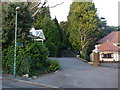
Talbot Woods: footpath A13 into Pug?s Hole from Branksome Hill Road
Before the recent rebuilds of the houses either side, this was a fairly conspicuous path – now, it is a gravelled walkway between the new driveways.
See Image for the next photo along the footpath.
Image: © Chris Downer
Taken: 6 Dec 2009
0.04 miles
5
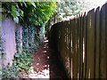
Talbot Woods: footpath A13 approaches Pug?s Hole
Looking along this public footpath, a little further on from Image, as it approaches Image
See Image for a picture of the far end of the path, as it leaves the wood.
Image: © Chris Downer
Taken: 28 Jun 2016
0.05 miles
6
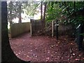
Talbot Woods: footpath A13 enters Pug?s Hole
A view, in a rain heavier than a drizzle, at the south end of Image, from which this public footpath leads to Branksome Hill Road.
The route of the footpath is clearly shown on maps as emerging from between the fences (left) and then turning left, ending at the gateway of which only the gateposts survive (right). It isn't now necessary to come through the gateway, though, as there is no fence to prevent direct access to here.
See Image for the next view along the footpath.
Image: © Chris Downer
Taken: 28 Jun 2016
0.06 miles
7
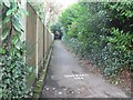
Bournemouth: higher footpath to Branksome Wood Road
Branksome Wood Road runs parallel with much of the Gardens and has access to them by way of two footpaths, this being the more upstream.
Image: © Chris Downer
Taken: 27 Jan 2008
0.08 miles
8
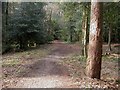
Bournemouth, Pug's Hole
Local Nature Reserve, supposedly named after a smuggler; path through valley, planted mainly with conifers. For more information, see http://www.bournemouth.gov.uk/Library/PDF/Landscape/DRAFT%20WOODLAND%20STRATEGY%2006-2006.pdf
Image: © Mike Faherty
Taken: 22 Feb 2009
0.10 miles
9
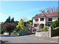
Benellen Rd
Benellen Road is a short residential street with substantial individual houses, many with private swimming pools. It runs between Glenferness Avenue and Benellen Avenue just north of the Bourne river.
Image: © Nigel Mykura
Taken: 8 May 2012
0.10 miles
10
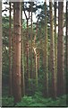
Talbot Woods: tall pines in Pug?s Hole
Tall spindly pine trees in this little woodland area off Glenferness Avenue.
Image: © Chris Downer
Taken: Unknown
0.10 miles