
IMAGES TAKEN NEAR TO
Plumley, RINGWOOD, BH24 3QB
Introduction
This page details the photographs taken nearby to BH24 3QB by members of the Geograph project.
The Geograph project started in 2005 with the aim of publishing, organising and preserving representative images for every square kilometre of Great Britain, Ireland and the Isle of Man.

There are currently over 7.5m images from over14,400 individuals and you can help contribute to the project by visiting https://www.geograph.org.uk
Image Map
Images are licensed for reuse under creativecommons.org/licenses/by-sa/2.0
Notes
- Clicking on the map will re-center to the selected point.
- The higher the marker number, the further away the image location is from the centre of the postcode.
Image Listing (9 Images Found)
Images are licensed for reuse under creativecommons.org/licenses/by-sa/2.0
Image
Details
Distance
1

Harbridge, Harefield Lodge
On the forestry road and right of way to North Plumley; presumably named after the neighbouring plantation.
Image: © Mike Faherty
Taken: 19 Feb 2012
0.00 miles

3

Harbridge, conveyor belt
Possibly still under construction, serving the gravel and sand pit to the South, which is shown on OS as "Pit dis": it is obviously alive and well. There is a similar belt to the North, serving a new pit.
Image: © Mike Faherty
Taken: 19 Feb 2012
0.08 miles
4
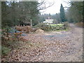
Plumley Farm, Ringwood Forest
Plumley Farm is close to the Ringwood - Alderholt road. It is on the eastern edge of the Ringwood Forest.
Image: © Stuart Buchan
Taken: 6 Jan 2006
0.11 miles
5

Harbridge, Plumley Farm
Almost surrounded by sand and gravel pits, but the guinea fowl seen didn't seem perturbed.
Image: © Mike Faherty
Taken: 19 Feb 2012
0.20 miles
7

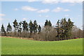
Harbridge, pipes
Next to Plumley Farm. Connected with the new sand and gravel pit, or agricultural?
Image: © Mike Faherty
Taken: 19 Feb 2012
0.20 miles
8

Harbridge, sandheaps
On the farm road and footpath from North Plumley to Plumley Farm; presumably excavated from the neighbouring pit. There is a similar heap on the other side of the road.
Image: © Mike Faherty
Taken: 19 Feb 2012
0.22 miles
9
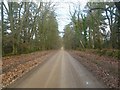
Harbridge, forestry road
Giving access from The Belt to plantations in Ringwood Forest, local farms and properties, and sand and gravel pits.
Image: © Mike Faherty
Taken: 19 Feb 2012
0.22 miles