
IMAGES TAKEN NEAR TO
Hopclover Way, RINGWOOD, BH24 3FQ
Introduction
This page details the photographs taken nearby to Hopclover Way, BH24 3FQ by members of the Geograph project.
The Geograph project started in 2005 with the aim of publishing, organising and preserving representative images for every square kilometre of Great Britain, Ireland and the Isle of Man.

There are currently over 7.5m images from over14,400 individuals and you can help contribute to the project by visiting https://www.geograph.org.uk
Image Map
Images are licensed for reuse under creativecommons.org/licenses/by-sa/2.0
Notes
- Clicking on the map will re-center to the selected point.
- The higher the marker number, the further away the image location is from the centre of the postcode.
Image Listing (23 Images Found)
Images are licensed for reuse under creativecommons.org/licenses/by-sa/2.0
Image
Details
Distance
1
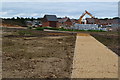
New development south of Ringwood
Seen from the former railway trackbed.
Image: © David Martin
Taken: 20 Aug 2018
0.06 miles
2

Castleman Trailway, Ringwood
A view along the Castleman Trailway as it heads into Ringwood. This section of the path occupies a former railway trackbed. The railway closed in the 1960s under the "Beeching Cuts".
Image: © Malc McDonald
Taken: 12 Apr 2025
0.09 miles
3
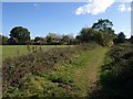
Path along former railway line east of Ringwood
Further east along Image, now classified as Ringwood Footpath 503, and approaching Crow Lane, which the houses are on.
Image: © Derek Harper
Taken: 12 Oct 2009
0.09 miles
4
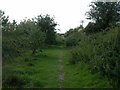
Ringwood, railway trackbed
Trackbed of the old Ringwood-Brockenhurst railway line, now a footpath with plenty of rabbit activity. http://homepage.ntlworld.com/ron.strutt/rrcor2.html
Image: © Mike Faherty
Taken: 3 Aug 2009
0.10 miles
5
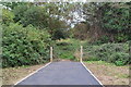
End of the tarmac path
This area to the south of Ringwood is undergoing substantial new residential development. Here, the newly laid tarmac path (on the former railway trackbed) comes to a sudden end between two posts.
Image: © David Martin
Taken: 20 Aug 2018
0.10 miles
6

Fields near Hightown Lake
The lake is behind the row of poplars. This view is from Ringwood Bridleway 509 as it follows the former railway line just east of Crow Lane.
Image: © Derek Harper
Taken: 12 Oct 2009
0.17 miles
7
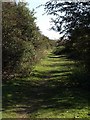
Path along former railway line, Ringwood
Taken further east than Image, looking along the dismantled line of the Dorchester to Southampton railway. This becomes Ringwood Footpath 503 in a few hundred metres, but why not here?
Image: © Derek Harper
Taken: 12 Oct 2009
0.17 miles
8
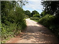
Crow, railway trackbed
Trackbed of the old Dorchester-Southampton railway, here, from Ringwood South-east to Brockenhurst, now a footpath. http://www.transportdiversions.com/publicationshow.asp?pubid=6631
Image: © Mike Faherty
Taken: 3 Aug 2009
0.17 miles
9
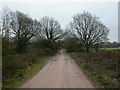
Hightown, bridleway
From Hightown to Crow, on the trackbed of the old Southampton to Dorchester Railway; also access road to Hightown Lake.
Image: © Mike Faherty
Taken: 30 Dec 2010
0.20 miles
10
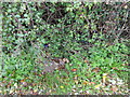
Ordnance Survey triangulation bolt
Large surface bolt set in to a concrete block by the former railway bridge on Crow Arch Lane.
Image: © Mat Tuck
Taken: 3 Nov 2013
0.21 miles