IMAGES TAKEN NEAR TO
Highfield Avenue, RINGWOOD, BH24 1RH
Introduction
This page details the photographs taken nearby to Highfield Avenue, BH24 1RH by members of the Geograph project.
The Geograph project started in 2005 with the aim of publishing, organising and preserving representative images for every square kilometre of Great Britain, Ireland and the Isle of Man.

There are currently over 7.5m images from over14,400 individuals and you can help contribute to the project by visiting https://www.geograph.org.uk
Image Map
Images are licensed for reuse under creativecommons.org/licenses/by-sa/2.0
Notes
- Clicking on the map will re-center to the selected point.
- The higher the marker number, the further away the image location is from the centre of the postcode.
Image Listing (33 Images Found)
Images are licensed for reuse under creativecommons.org/licenses/by-sa/2.0
Image
Details
Distance
2
Ringwood, Gravel Lane
Lane from Salisbury Road towards the town centre; cut off at its southern end by the by-pass. It also forms part of the Avon Valley Path.
Image: © Mike Faherty
Taken: 12 Feb 2011
0.14 miles
3
Garage at the bottom of Northfield Road, Ringwood
A garage has been here for at least fifty years. The forecourt of what is now Nu-Car Diesel Centre used to be a filling station, and was one of the last in the Ringwood area to offer a pump attendant to do the filling for you.
Beyond is the junction with the A338 Ringwood to Salisbury road. According to my 1921 New Forest map, this road here, which is named Salisbury Road, was the main road to Salisbury until the bigger and better A338 was built, some time before 1947.
Image: © Peter Facey
Taken: 11 Apr 2008
0.14 miles
4
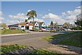
Wells Garage, Salisbury Road, Ringwood
The garage, in the wooden-clad building, has been here for many years. See also Image
Image: © Peter Facey
Taken: 11 Apr 2008
0.15 miles
5
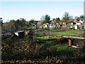
Ringwood, allotments
Municipal allotments off Southampton Road.
Image: © Mike Faherty
Taken: 9 Jan 2011
0.16 miles
6
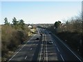
Ringwood, A31(T)
Looking towards Poulner Hill from the westerly of two bridges on Southampton Road.
Image: © Mike Faherty
Taken: 9 Jan 2011
0.18 miles
9
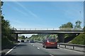
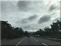
Bridge over A31 in Ringwood
This carries Southampton Road; the route of this urban road was changed so that the bridge is almost at a right angle to the dual carriageway A31, while the angle between Southampton Road and the A31 is close to 30 degrees
Image: © David Smith
Taken: 3 May 2014
0.19 miles