IMAGES TAKEN NEAR TO
Manor Road, RINGWOOD, BH24 1RA

Introduction

This page details the photographs taken nearby to Manor Road, BH24 1RA by members of the Geograph project.

The Geograph project started in 2005 with the aim of publishing, organising and preserving representative images for every square kilometre of Great Britain, Ireland and the Isle of Man.

There are currently over 7.5m images from over14,400 individuals and you can help contribute to the project by visiting https://www.geograph.org.uk

Image Map


Images are licensed for reuse under creativecommons.org/licenses/by-sa/2.0
Notes
  • Clicking on the map will re-center to the selected point.
  • The higher the marker number, the further away the image location is from the centre of the postcode.

Image Listing (30 Images Found)

Images are licensed for reuse under creativecommons.org/licenses/by-sa/2.0
  • ...
Image
Details
Distance
1
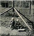
Post-war Prefab back garden - Ringwood c.1950
My parents like many, were allocated a prefab council building in 1946 after my father was demobbed from his wartime service with the RAF. The strange structure framing my brother and I are the tripod legs of a war surplus tactical signals radio mast, on which was mounted a television aerial about 60 ft up. My father had built our own television set from war surplus components, and the aerial system for it was designed to receive the VHF 405 line television signal from the transmitter on the Isle of Wight about 22 miles away. In the immediate post-war period with most commodities subject to rationing, large gardens were provided with the prefabs to encourage people to grow their own fruit and veg. Seen in the background is our back garden complete with a hen house and run that accommodated several hens. The garden area at the front was about half the size of the back garden, in which altogether I can recall we grew potatoes, cabbage, runner beans, strawberries, and raspberries the like of which I've never tasted since. I would be most interested to learn more about this ex-WD transportable tactical signals mast. It was a sectional mast, each component being identical sections of hollow tubular preformed plywood, and the mast was erected via a standard tilt-over derrick system. I have never come across anything quite like it anywhere, but it must have served some signals purpose during WW2. Turnbuckles can be seen that tensioned the tripod legs, whilst guy ropes gave the mast section stability. The assembly was firmly anchored to the ground by three chains attached to each leg. It ended its days during a March gale, when it blew down, ending up horizontal straddling our neighbour's fence with the aerial poised just 6ft away from their bedroom window!
Image: © Ronald Searle Taken: 1 Jan 1950
0.04 miles
2
A31
Image: © N Chadwick Taken: 27 Sep 2014
0.05 miles
3
Ringwood, pub site
On Southampton Road, once "Hunters Lodge", now a development site; see Image before the building was demolished.
Image: © Mike Faherty Taken: 9 Jan 2011
0.06 miles
4
Derelict pub
The Hunters Lodge awaiting a new owner or the bulldozer
Image: © william Taken: 28 Apr 2009
0.07 miles
5
A31, westbound
Image: © N Chadwick Taken: 29 Jun 2013
0.08 miles
6
Ringwood School
Seen from the eastern entrance.
Image: © Peter Facey Taken: 28 May 2006
0.10 miles
7
A31 at Ringwood, looking east from Southampton Road bridge
Image: © David Martin Taken: 24 Apr 2016
0.11 miles
8
Footbridge over the A31
Image: © N Chadwick Taken: 29 Jun 2013
0.11 miles
9
Footbridge over A31 in Ringwood
The bridge follows the line of a suburban road which was cut by the dual carriageway. Vehicles following this former through route travel an extra half a mile to cross the A31
Image: © David Smith Taken: 3 May 2014
0.11 miles
10
A31, Ringwood
Image: © David Dixon Taken: 1 Apr 2013
0.11 miles
  • ...