
IMAGES TAKEN NEAR TO
Gravel Lane, RINGWOOD, BH24 1LL
Introduction
This page details the photographs taken nearby to Gravel Lane, BH24 1LL by members of the Geograph project.
The Geograph project started in 2005 with the aim of publishing, organising and preserving representative images for every square kilometre of Great Britain, Ireland and the Isle of Man.

There are currently over 7.5m images from over14,400 individuals and you can help contribute to the project by visiting https://www.geograph.org.uk
Image Map
Images are licensed for reuse under creativecommons.org/licenses/by-sa/2.0
Notes
- Clicking on the map will re-center to the selected point.
- The higher the marker number, the further away the image location is from the centre of the postcode.
Image Listing (33 Images Found)
Images are licensed for reuse under creativecommons.org/licenses/by-sa/2.0
Image
Details
Distance
1
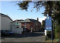
Ringwood, care home
Whitegates Residential Care Home, on Gravel Lane. http://www.carehome.co.uk/carehome.cfm/searchazref/10001035WHIH
Image: © Mike Faherty
Taken: 12 Feb 2011
0.03 miles
2
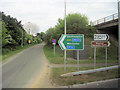
East to Southampton
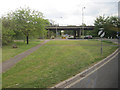
Slip road to A31 eastbound at Ringwood
Image: © John Firth
Taken: 10 May 2010
0.07 miles
4
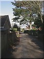
Ringwood, Gravel Lane
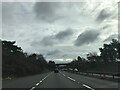
Lane from Salisbury Road towards the town centre; cut off at its southern end by the by-pass. It also forms part of the Avon Valley Path.
Image: © Mike Faherty
Taken: 12 Feb 2011
0.10 miles
7
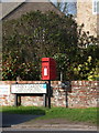
Ringwood: postbox № BH24 69, Southampton Road
This postbox stands on the corner of Linden Gardens and receives its final collection at 4pm on weekdays and at noon on Saturdays.
Image: © Chris Downer
Taken: 20 Mar 2011
0.14 miles
9
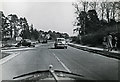
A31/A338 junction viewed from a Morris 8 - Ringwood 1956 (1)
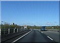
The view of what used to be the main A31 Southampton road from Ringwood (the Ringwood bypass) at its junction with the A338 to Fordingbridge and Salisbury. Photographed through the windscreen of my father's Morris 8 saloon reg. no. ERU 765. Some interesting vehicles observed, a 1948 Morris Minor split screen saloon (reg. no. JOV 68) approaches in the opposite carriageway, whilst an unidentified Standard or Vauxhall (reg. no. PUK 948) emerges from the A338. Beyond is a motorcycle and sidecar combination that may have broken down, partially blocking the eastbound single carriageway of the A31 (as it was back then).
Today the main A31 has been elevated over this very spot via a modern flyover, whose dual carriageway carries thousands of vehicles per day overhead. This former road junction has long since been revamped too with a roundabout that acts now merely as a feeder for traffic entering and leaving the A31/A338. The next photo is of the same stretch of the A31 travelling in the same direction about 200 yards further along.
Image
Image: © Ronald Searle
Taken: 31 Mar 1956
0.16 miles
10
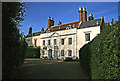
The Manor House - Ringwood
Once the residence of the Lord Chief Justice of England, William Murray (1705 - 1793), 1st Earl of Mansfield. The main building dates from the early C18, with the west wing (now a separate residence) dating from the late C18. Grade II* Listed.
Image: © Mike Searle
Taken: 25 Nov 2007
0.16 miles