
IMAGES TAKEN NEAR TO
Tucks Close, CHRISTCHURCH, BH23 8ND
Introduction
This page details the photographs taken nearby to Tucks Close, BH23 8ND by members of the Geograph project.
The Geograph project started in 2005 with the aim of publishing, organising and preserving representative images for every square kilometre of Great Britain, Ireland and the Isle of Man.

There are currently over 7.5m images from over14,400 individuals and you can help contribute to the project by visiting https://www.geograph.org.uk
Image Map
Images are licensed for reuse under creativecommons.org/licenses/by-sa/2.0
Notes
- Clicking on the map will re-center to the selected point.
- The higher the marker number, the further away the image location is from the centre of the postcode.
Image Listing (26 Images Found)
Images are licensed for reuse under creativecommons.org/licenses/by-sa/2.0
Image
Details
Distance
1
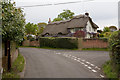
The Old Cottage, Chapel Lane
Chapel Lane to right. Camera held above head.
Image: © Peter Facey
Taken: 13 May 2010
0.04 miles
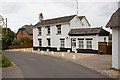
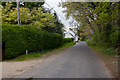
4

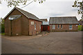
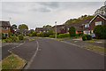
Narrow Footpath at Bransgore
This straight, narrow path connects Chapel Lane with Brookside Road.
Image: © mike smith
Taken: 12 Jul 2012
0.11 miles
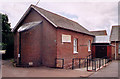

9
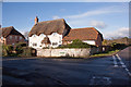
Jasmine Cottage, Derritt Lane
Both of these thatched cottages were recently built at time of photographing. In January 2016, Google StreetView and Bing aerials show the houses that were there before, and Google aerial shows the foundations of the new cottages. The original boundary wall has been retained where the street sign is, but replaced with brick beside the new garage.
Image: © Peter Facey
Taken: 14 Jan 2016
0.14 miles
10
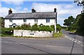
Junction Ringwood Road and Derritt Lane
Ringwood Road continues ahead towards the market town of Ringwood.
The white house appears to be two dwellings, although the only sign visible reads "Corner Cottage".
Image: © mike smith
Taken: 17 Jul 2012
0.15 miles