
IMAGES TAKEN NEAR TO
Burley Road, CHRISTCHURCH, BH23 8DR
Introduction
This page details the photographs taken nearby to Burley Road, BH23 8DR by members of the Geograph project.
The Geograph project started in 2005 with the aim of publishing, organising and preserving representative images for every square kilometre of Great Britain, Ireland and the Isle of Man.

There are currently over 7.5m images from over14,400 individuals and you can help contribute to the project by visiting https://www.geograph.org.uk
Image Map
Images are licensed for reuse under creativecommons.org/licenses/by-sa/2.0
Notes
- Clicking on the map will re-center to the selected point.
- The higher the marker number, the further away the image location is from the centre of the postcode.
Image Listing (83 Images Found)
Images are licensed for reuse under creativecommons.org/licenses/by-sa/2.0
Image
Details
Distance
1

Forest Edge, Thorney Hill, near Bransgore
Forest Edge is an unmade road in the hamlet of Thorney Hill, in the New Forest National Park.
This image was taken in December 2024, after a prolonged wet spell. The road was muddy as a result.
Image: © Malc McDonald
Taken: 28 Dec 2024
0.03 miles
2

School Road, Thorney Hill, near Bransgore
School Road is a minor lane in the hamlet of Thorney Hill, in the New Forest National Park.
This image was taken on a dull and murky day in late December. Deciduous trees were bare for the winter season.
Image: © Malc McDonald
Taken: 28 Dec 2024
0.03 miles
3
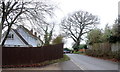
School Road.
School Rd is one of the older roads of Thorney Hill. It cuts the corner between the Burley rd and Forest Rd.
Image: © Nigel Mykura
Taken: 6 Mar 2019
0.03 miles
4
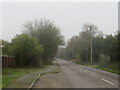
Burley Road, Thorney Hill, near Bransgore
Burley Road is a minor road which heads from the village of Bransgore into the New Forest National Park. This image looks southwards as the road passes through the hamlet of Thorney Hill.
This image was taken on a dull and murky day in late December. Deciduous trees were bare for the winter season.
Image: © Malc McDonald
Taken: 28 Dec 2024
0.05 miles
5
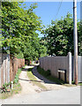
School Lane, Thorney Hill
A cul de sac running north from School Road and affording access to private houses.
Image: © Peter Facey
Taken: 3 Jun 2010
0.05 miles
6

School Road, Thorney Hill, near Bransgore
School Road is a minor road in the hamlet of Thorney Hill, in the New Forest National Park.
This image was taken on a dull and murky day in late December. Deciduous trees were bare for the winter season.
Image: © Malc McDonald
Taken: 28 Dec 2024
0.06 miles
7
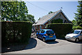
Villajoyosa, School Road, Thorney Hill
Formerly a Methodist Chapel, it is still marked with a cross on some road maps but, I was told, it became a private bungalow in the 1960s.
Image: © Peter Facey
Taken: 3 Jun 2010
0.06 miles
8

Burley Road, Thorney Hill, near Bransgore
Burley Road is a minor road which heads from the village of Bransgore into the New Forest National Park. This image looks southwards as the road passes through the hamlet of Thorney Hill.
This image was taken on a dull and murky day in late December. Deciduous trees were bare for the winter season.
Image: © Malc McDonald
Taken: 28 Dec 2024
0.07 miles
9
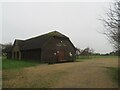
Thorney Hill Community Centre, near Bransgore
Thorney Hill Community Centre is a community hall in the hamlet of Thorney Hill, in the New Forest National Park.
Image: © Malc McDonald
Taken: 28 Dec 2024
0.07 miles
10
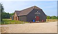
Thorney Hill Community Centre
This smart community centre is in the village of Thorney Hill, although their website indicates that it is for the people of Bransgore, which is the next village to the south-west.
Image: © mike smith
Taken: 22 Jul 2013
0.08 miles