
IMAGES TAKEN NEAR TO
Burley Road, CHRISTCHURCH, BH23 8DF
Introduction
This page details the photographs taken nearby to Burley Road, BH23 8DF by members of the Geograph project.
The Geograph project started in 2005 with the aim of publishing, organising and preserving representative images for every square kilometre of Great Britain, Ireland and the Isle of Man.

There are currently over 7.5m images from over14,400 individuals and you can help contribute to the project by visiting https://www.geograph.org.uk
Image Map
Images are licensed for reuse under creativecommons.org/licenses/by-sa/2.0
Notes
- Clicking on the map will re-center to the selected point.
- The higher the marker number, the further away the image location is from the centre of the postcode.
Image Listing (6 Images Found)
Images are licensed for reuse under creativecommons.org/licenses/by-sa/2.0
Image
Details
Distance
1

Thorney Hill, Burley Road
The road from Bransgore to Burley; lined with houses, a church, and horse grazings.
Image: © Mike Faherty
Taken: 10 Apr 2011
0.02 miles
2
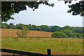
Landscape south of Thorney Hill
This attractive view is seen from Burley Road, looking to the north-east.
Image: © mike smith
Taken: 22 Jul 2013
0.08 miles
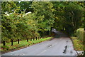
4
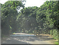
Cattle grid on Burley Road
Cattle grids abound at the edge of the New Forest. Inside them ponies and kine are free to roam, outside petunias can sleep safe in their beds.
Image: © Stuart Logan
Taken: 7 Aug 2013
0.21 miles
5
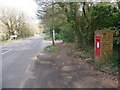
Bransgore: postbox № BH23 33, Burley Road
This George V-reign postbox, set into a brick pillar, is empties at 4pm on weekdays and at 7:45am on Saturdays. The sign in the background says Thorney Hill, while the corresponding one for Bransgore is directly opposite it, obscured from here by foliage.
Image: © Chris Downer
Taken: 1 Mar 2009
0.23 miles
6

Thorney Hill, cattle grid
On Burley Road; beyond, the village, and then open forest.
Image: © Mike Faherty
Taken: 10 Apr 2011
0.25 miles