
IMAGES TAKEN NEAR TO
Bute Drive, CHRISTCHURCH, BH23 5LE
Introduction
This page details the photographs taken nearby to Bute Drive, BH23 5LE by members of the Geograph project.
The Geograph project started in 2005 with the aim of publishing, organising and preserving representative images for every square kilometre of Great Britain, Ireland and the Isle of Man.

There are currently over 7.5m images from over14,400 individuals and you can help contribute to the project by visiting https://www.geograph.org.uk
Image Map
Images are licensed for reuse under creativecommons.org/licenses/by-sa/2.0
Notes
- Clicking on the map will re-center to the selected point.
- The higher the marker number, the further away the image location is from the centre of the postcode.
Image Listing (51 Images Found)
Images are licensed for reuse under creativecommons.org/licenses/by-sa/2.0
Image
Details
Distance
1
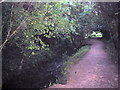
Chewton Bunny
The path follows the stream through woods - this is a view looking south west.
Image: © Stephen Williams
Taken: 19 Jun 2007
0.05 miles
2
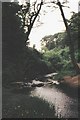
Chewton Bunny ? county boundary since 1974
This unremarkable stream became slightly more noteworthy on 1 April 1974 when it became the boundary between Hampshire and Dorset.
Image: © Chris Downer
Taken: Unknown
0.05 miles
3
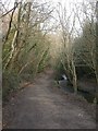
Chewton Bunny, Walkford Brook
The brook flows south from near Bransgore, and discharges into the sea 300m south of here. For most of its length from the A337 to the sea, it can be followed by footpath. Bunny is a local word for valley; here, the valley is wooded, mainly oak, beech & holly.
Image: © Mike Faherty
Taken: 30 Dec 2008
0.06 miles
4
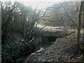
Chewton Bunny, Walkford Brook culvert
Shortly before it flows into the sea, Walkford Brook is culverted and flows underground for 250m, possibly to allow visitors to walk along the clifftop unhindered. This is the northern end of the culvert.
Image: © Mike Faherty
Taken: 30 Dec 2008
0.08 miles
5
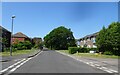
Jays Court View
The view of Montagu Road in Highcliffe, Dorset.
Image: © Gordon Griffiths
Taken: 3 Jun 2023
0.09 miles
6
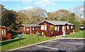
Holiday Lodges at Naish Park
In addition to static caravans, this holiday park has many wooden lodges or chalets.
Image: © mike smith
Taken: 27 Nov 2011
0.14 miles
7
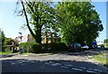
Mill Lane Junction
The view of Montagu Road in Highcliffe, Dorset.
Image: © Gordon Griffiths
Taken: 3 Jun 2023
0.14 miles
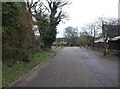
9
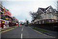
Highcliffe-on-Sea : Stuart Road
Looking along Stuart Road off of Lymington Road.
Image: © Lewis Clarke
Taken: 26 Mar 2018
0.15 miles
10
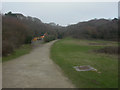
Chewton Bunny
Strange flat, open piece of grassland above Walkford Brook, extending about 250m from the northern Image to the southern Image mouths of the culvert; perhaps the brook was put underground to make access to the clifftops to the west (in Highcliffe) and east (in Barton) easier. The grassland is always damp, because of surface water. Engineers' depot to the left, inspection chamber for the brook to the right.
Image: © Mike Faherty
Taken: 30 Dec 2008
0.16 miles