IMAGES TAKEN NEAR TO
Terrington Avenue, CHRISTCHURCH, BH23 4RL
Introduction
This page details the photographs taken nearby to Terrington Avenue, BH23 4RL by members of the Geograph project.
The Geograph project started in 2005 with the aim of publishing, organising and preserving representative images for every square kilometre of Great Britain, Ireland and the Isle of Man.

There are currently over 7.5m images from over14,400 individuals and you can help contribute to the project by visiting https://www.geograph.org.uk
Image Map
Images are licensed for reuse under creativecommons.org/licenses/by-sa/2.0
Notes
- Clicking on the map will re-center to the selected point.
- The higher the marker number, the further away the image location is from the centre of the postcode.
Image Listing (11 Images Found)
Images are licensed for reuse under creativecommons.org/licenses/by-sa/2.0
Image
Details
Distance
1
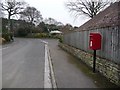
Highcliffe: postbox № BH23 85, Langley Road
This small postbox serves the northern extremity of Highcliffe and is emptied finally at 4:45pm on weekdays and at 12:30pm on Saturdays.
Image: © Chris Downer
Taken: 31 Jan 2009
0.06 miles
2
Hintonwood Avenue junction with Woodhayes Avenue
Image: © Stuart Logan
Taken: 7 Aug 2013
0.15 miles
3
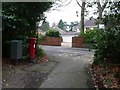
Highcliffe: postbox № BH23 9, Hinton Wood Avenue
This postbox stands on a short pedestrian cut-through between Hinton Wood Avenue and Oakwood Road, and is cleared finally at 4:45pm on weekdays and at 12:30pm on Saturdays.
Image: © Chris Downer
Taken: 31 Jan 2009
0.16 miles
4
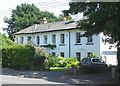
Cranemoor House
This large country house was built in the 19th century. The grounds originally extended north to the railway line, but that land is now occupied by numerous bungalows. In the 1930s it was a private school, and during WWII was used by the fire service. It is now three separate dwellings.
Image: © mike smith
Taken: 12 Jul 2007
0.19 miles
5
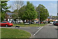
Triangular green beside Clive Road and Havelock Way
Image: © David Martin
Taken: 23 Apr 2022
0.20 miles