
IMAGES TAKEN NEAR TO
Hazel Close, CHRISTCHURCH, BH23 4PS
Introduction
This page details the photographs taken nearby to Hazel Close, BH23 4PS by members of the Geograph project.
The Geograph project started in 2005 with the aim of publishing, organising and preserving representative images for every square kilometre of Great Britain, Ireland and the Isle of Man.

There are currently over 7.5m images from over14,400 individuals and you can help contribute to the project by visiting https://www.geograph.org.uk
Image Map
Images are licensed for reuse under creativecommons.org/licenses/by-sa/2.0
Notes
- Clicking on the map will re-center to the selected point.
- The higher the marker number, the further away the image location is from the centre of the postcode.
Image Listing (26 Images Found)
Images are licensed for reuse under creativecommons.org/licenses/by-sa/2.0
Image
Details
Distance
1
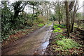
Old Track Near Highcliffe
This old track has probably existed for hundreds of years. On old maps it is shown as a lane providing access to large houses most of which have disappeared and whose land has been built on. It now runs south from the A35 to Smugglers Lane North
Image: © Nigel Mykura
Taken: 6 Mar 2019
0.06 miles
2
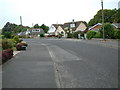
Forest Way, Highcliffe, Dorset
This is a residential area with Highcliffe School at its centre.
Image: © Stuart Buchan
Taken: 14 Jun 2006
0.07 miles
3
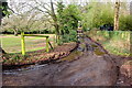
Verno Lane
Described as being unsuitable for motor vehicles this track is an old lane that runs from the A35 to Smugglers lane North. This is just adjacent to the top end of the cul-de-sac known as Hazel Close.
Image: © Nigel Mykura
Taken: 6 Mar 2019
0.09 miles
4
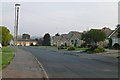
Bungalows on Smugglers Wood Road
Suburbam Christchurch.
Image: © David Lally
Taken: 23 Sep 2014
0.12 miles
5
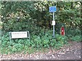
Christchurch: postbox № BH23 12, Verno Lane
A Victorian postbox set into an ivy-clad brick pillar, a little way down this minor gravel track.
Image: © Chris Downer
Taken: 18 Oct 2008
0.12 miles
6
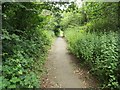
Footpath on Roeshot Hill
This footpath is the pavement along the A35, but is separated from the road by trees and shrubs.
Image: © mike smith
Taken: 19 Jul 2007
0.13 miles
7
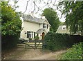
"The Lodge"
This 19th century house is by the former north entrance to the Holburne Country Estate. It is now just a private home on the A35 at Roeshot Hill.
Image: © mike smith
Taken: 19 Jul 2007
0.14 miles
8
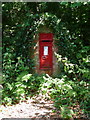
Highcliffe: Victorian postbox in Verno Lane
A close-up of Image
Image: © Chris Downer
Taken: 9 Aug 2009
0.14 miles
9

Christchurch : Lyndhurst Road A35
A road heading into the town of Christchurch.
Image: © Lewis Clarke
Taken: 25 Mar 2018
0.15 miles
10
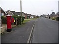
Highcliffe: postbox № BH23 93, Nada Road
Nada Road is typical of the Highcliffe suburbs – smart modernish bungalows unfenced between gardens and road. The postbox, an Elizabeth II-reign one at the eastern end of the road, is emptied finally at 5:30pm on weekdays and at 12:30pm on Saturdays.
Image: © Chris Downer
Taken: 31 Jan 2009
0.16 miles