IMAGES TAKEN NEAR TO
Seaway Avenue, CHRISTCHURCH, BH23 4EU
Introduction
This page details the photographs taken nearby to Seaway Avenue, BH23 4EU by members of the Geograph project.
The Geograph project started in 2005 with the aim of publishing, organising and preserving representative images for every square kilometre of Great Britain, Ireland and the Isle of Man.

There are currently over 7.5m images from over14,400 individuals and you can help contribute to the project by visiting https://www.geograph.org.uk
Image Map (Loading...)


Getting Data...Please wait
Leaflet Map data © OpenStreetMap
Images are licensed for reuse under creativecommons.org/licenses/by-sa/2.0
Notes
- Clicking on the map will re-center to the selected point.
- The higher the marker number, the further away the image location is from the centre of the postcode.
Image Listing (56 Images Found)
Images are licensed for reuse under creativecommons.org/licenses/by-sa/2.0
Image
Details
Distance
1
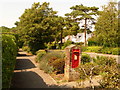
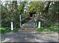
Christchurch: postbox № BH23 32, Seaway Avenue
A George V-reign postbox, set into an attractive brick pillar, emptied finally at 5:30pm on weekdays and at 12:15pm on Saturdays.
Image: © Chris Downer
Taken: 9 Aug 2009
0.12 miles
2
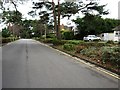
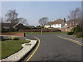
Seaway, Friars Cliff, close to junction with Bure Lane
Image: © David Gearing
Taken: 28 Feb 2011
0.14 miles
6
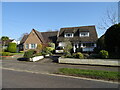
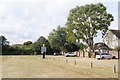
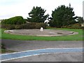
Friar's Cliff, tumulus
Tumulus on Glengarry Way, opposite junction Vecta Close. Very inconspicuous; passers-by must think this is a patch of waste land, but it is marked as tumulus on the local A-Z.
Image: © Mike Faherty
Taken: 20 Mar 2009
0.17 miles
8
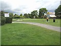
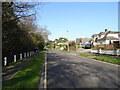
Southcliffe Road Car Park
This is an all-grass car park, and despite the heavy rains of summer 2007, appears to be in good condition. Perhaps there were few visitors!
Image: © mike smith
Taken: 22 Jul 2007
0.19 miles
9
Concrete Base, Skynet Radome
This concrete base close to the seafront at Friarsclif east of Christchurch once supported a large radome which was part of the UK's first aerial defence system known as Skynet.
Image: © Nigel Mykura
Taken: 31 Oct 2009
0.19 miles
10
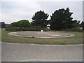
Remains of the Beehive
The Beehive was the local name given to a then secret Cold War satellite tracking station.
The object in the middle is a commemoration stone for the site.
Image: © Anthony Vosper
Taken: 23 Aug 2013
0.19 miles