IMAGES TAKEN NEAR TO
Wilverley Road, CHRISTCHURCH, BH23 3RU
Introduction
This page details the photographs taken nearby to Wilverley Road, BH23 3RU by members of the Geograph project.
The Geograph project started in 2005 with the aim of publishing, organising and preserving representative images for every square kilometre of Great Britain, Ireland and the Isle of Man.

There are currently over 7.5m images from over14,400 individuals and you can help contribute to the project by visiting https://www.geograph.org.uk
Image Map
Images are licensed for reuse under creativecommons.org/licenses/by-sa/2.0
Notes
- Clicking on the map will re-center to the selected point.
- The higher the marker number, the further away the image location is from the centre of the postcode.
Image Listing (35 Images Found)
Images are licensed for reuse under creativecommons.org/licenses/by-sa/2.0
Image
Details
Distance
1
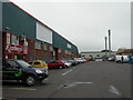
Somerford Business Park
Off Wilverley Road. Businesses include tyres, carpets, disc repair and glass.
Image: © Mike Faherty
Taken: 26 Aug 2010
0.02 miles
2

Angling lake, Mudeford Woods
Looking across the northernmost of the lakes.
Image: © Peter Beaven
Taken: 26 Apr 2007
0.07 miles
3
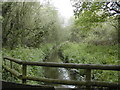
Mudeford Woods
The River Mude, looking upstream.
Image: © Peter Beaven
Taken: 26 Apr 2007
0.08 miles
4
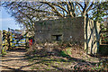
WWII defences in the environs of Bournemouth & Christchurch: Wilverley Road, Christchurch - pillbox (1)
-
Pillbox (type FW3/26): DoB ID: e35574
Type 26 pillbox at the entrance to the Corporation tip at the edge of Mudeford Wood on Wilverley Road. Part of the defences that protected the wartime Airspeed aircraft factory and the airfield of RAF Christchurch. This is a 10 ft square pillbox having 3 embrasures on three of its sides, with a half-size entrance with a pistol port on the S. The entrance and all of the apertures have been blocked up.
Image
Image: © Mike Searle
Taken: 15 Mar 2016
0.09 miles
5
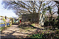
WWII defences in the environs of Bournemouth & Christchurch: Wilverley Road, Christchurch - pillbox (2)
-
Pillbox (type FW3/26): DoB ID: e35574
Type 26 pillbox on Wilverley Road next to the Corporation tip entrance, part of the wartime defences that protected the former Airspeed aircraft factory and the airfield of RAF Christchurch.
Image
Image: © Mike Searle
Taken: 15 Mar 2016
0.09 miles
6
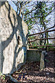
WWII defences in the environs of Bournemouth & Christchurch: Wilverley Road, Christchurch - pillbox (3)
-
Pillbox (type FW3/26): DoB ID: e35574
Type 26 pillbox on Wilverley Road next to the Corporation tip. The entrance with its low blast wall and pistol port - both now blocked up.
Image
Image: © Mike Searle
Taken: 15 Mar 2016
0.09 miles
7
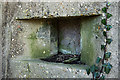
WWII defences in the environs of Bournemouth & Christchurch: Wilverley Road, Christchurch - pillbox (4)
-
Pillbox (type FW3/26): DoB ID: e35574
Type 26 pillbox on Wilverley Road next to the Corporation tip. One of the embrasures.
Image
Image: © Mike Searle
Taken: 15 Mar 2016
0.09 miles
9
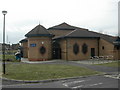
Meteor Shopping Park, Somerford Road, Christchurch
Across the busy Somerford Road.
Image: © Russel Wills
Taken: 14 Jul 2017
0.14 miles