
IMAGES TAKEN NEAR TO
Martins Drive, FERNDOWN, BH22 9SG
Introduction
This page details the photographs taken nearby to Martins Drive, BH22 9SG by members of the Geograph project.
The Geograph project started in 2005 with the aim of publishing, organising and preserving representative images for every square kilometre of Great Britain, Ireland and the Isle of Man.

There are currently over 7.5m images from over14,400 individuals and you can help contribute to the project by visiting https://www.geograph.org.uk
Image Map
Images are licensed for reuse under creativecommons.org/licenses/by-sa/2.0
Notes
- Clicking on the map will re-center to the selected point.
- The higher the marker number, the further away the image location is from the centre of the postcode.
Image Listing (14 Images Found)
Images are licensed for reuse under creativecommons.org/licenses/by-sa/2.0
Image
Details
Distance
1
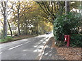
Ferndown: postbox № BH22 149, West Moors Road
This little postbox is on the corner of Beaufoys Avenue, a long road which is cut off at both ends. The box is emptied finally at 5:30pm on weekdays and at noon on Saturdays.
Image: © Chris Downer
Taken: 8 Nov 2008
0.07 miles
2
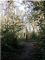
Ferndown, woodland
Mixed woodland off West Moors Road, the entrance to Slop Bog Local Nature Reserve & SSSI. http://www.slopbog.org.uk/
Image: © Mike Faherty
Taken: 1 Jan 2010
0.13 miles
3
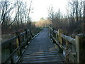
Slop Bog, boardwalk
Boardwalk allowing visitors to cross wet heathland of the nature reserve. http://www.lhi.org.uk/projects_directory/projects_by_region/south_west/dorset/slop_bog_access_and_understanding/index.html
Image: © Mike Faherty
Taken: 1 Jan 2010
0.16 miles
4
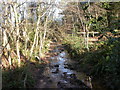
Slop Bog, stream
Stream draining into Uddens Water, in the wooded part of the nature reserve. http://www.dorsetforyou.com/media/pdf/f/r/Slop_bog_Leaflet.pdf
Image: © Mike Faherty
Taken: 1 Jan 2010
0.16 miles
5
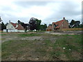
New Houses, Badgers Walk, Ferndown
Situated behind us there is a large area of woodland called 'The Warren', which has been cleared and earmarked for development.
Image: © Lorraine and Keith Bowdler
Taken: 23 May 2011
0.17 miles
6
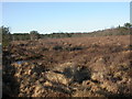
Slop Bog, heathland
Wet heathland on the nature reserve. http://www.dorsetforyou.com/media/pdf/f/r/Slop_bog_Leaflet.pdf
Image: © Mike Faherty
Taken: 1 Jan 2010
0.20 miles
8
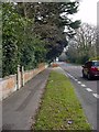
Wimborne Road (East), Ferndown - Old Nursery Wall
At first sight this is a most uninteresting view. However, this simple, yet elegant wall, which is well over a century old, is all that is left of a once vast enterprise of importance not only in the history of Ferndown (now the largest non-coastal community in Dorset), but also of seminal importance to national horticulture.
In 1859, the brothers William and David Stewart, the young heirs to a long-established Scottish plant nursery enterprise, decided to look to southern England for a milder base to extend their operations. They purchased a large expanse of land just south of West Moors (Dorset), north of the Wimborne to Ringwood road. The growing nursery helped encourage the development of Ferndown - indeed it was the Stewart brothers who decided to merge the original name (Fern Down).
David Stewart built a large house on the site - Ferndown Hill House - and this wall surrounded that property. When the house was demolished (I believe in the 1970s) the wall and main gate to the property were retained.
Image: © Martin Rowley
Taken: 21 Mar 2012
0.21 miles
9
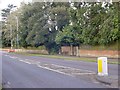
Old Main Gate: Stewart Family Home - Ferndown
This is the old gateway to Ferndown Hill House on Wimborne Road (East), Ferndown - the family home of the Stewart family. The nursery on this site has two claims to national fame: in 1955, they opened the first garden centre in the UK on this site - just a little way to the west of the family house. And in the same decade, as the firm relocated to a fresh site at Broomhill, near Wimborne Minster, the Stewarts introduced container-grown stock to the British horticultural industry, revolutionising production and sales.
As can be seen, the gateway has been bricked up. Behind the wall now lies an estate of houses – the wall is all that is left on this once great enterprise, though Stewart's Nursery still trades at Broomhill and elsewhere.
Image: © Martin Rowley
Taken: 21 Mar 2012
0.21 miles
10
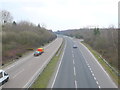
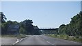
The A31
The A31 is the main road west out of Southampton along the coast and at this point it is circling round the north side of Ferndown to by pass it and take the through traffic away from the Poole Bournemouth conurbation.
Image: © Nigel Mykura
Taken: 28 Mar 2013
0.22 miles