
IMAGES TAKEN NEAR TO
Pinewood Road, FERNDOWN, BH22 9RR
Introduction
This page details the photographs taken nearby to Pinewood Road, BH22 9RR by members of the Geograph project.
The Geograph project started in 2005 with the aim of publishing, organising and preserving representative images for every square kilometre of Great Britain, Ireland and the Isle of Man.

There are currently over 7.5m images from over14,400 individuals and you can help contribute to the project by visiting https://www.geograph.org.uk
Image Map
Images are licensed for reuse under creativecommons.org/licenses/by-sa/2.0
Notes
- Clicking on the map will re-center to the selected point.
- The higher the marker number, the further away the image location is from the centre of the postcode.
Image Listing (6 Images Found)
Images are licensed for reuse under creativecommons.org/licenses/by-sa/2.0
Image
Details
Distance
1
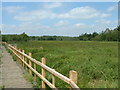
Slop Bog Nature Reserve
This 54-acre site is a haven for reptiles, birds and insects.
Image: © John Smitten
Taken: 15 Jul 2005
0.08 miles
2
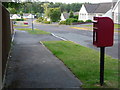
Ferndown: postbox № BH22 184, Willow Way
Beyond this postbox, we look down Willow Way, with bungalows typical of much of Ferndown.
Image: © Chris Downer
Taken: 15 Jun 2009
0.10 miles
3
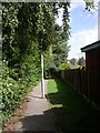
Ferndown, footpath
Between housing, from Redwood Drive to Pinewood Road.
Image: © Mike Faherty
Taken: 24 Aug 2010
0.18 miles
4
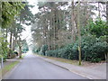
Beaufoys Avenue
Prior to the house building of the 20th C this area would have been pine covered sandy heathland. Some of the beautiful tall pines still remain even though the area is quite built up now.
Image: © Nigel Mykura
Taken: 28 Mar 2013
0.20 miles
5
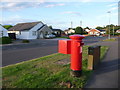
Ferndown: postbox № BH22 120, Coppice Avenue
This postbox is at the eastern end of Coppice Avenue, close to the junction of Ameysford Road. It is emptied finally at 5:15pm on weekdays and at 12:15pm on Saturdays.
Image: © Chris Downer
Taken: 15 Jun 2009
0.21 miles
6
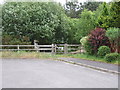
Entrance to Slop Bog, Ferndown
This entrance in Cedar Way,is one of three entrances into Slop Bog.
Slop Bog is a Local Nature Reserve covering 22.6 hectares. It is managed by Dorset Countryside.
Image: © Lorraine and Keith Bowdler
Taken: 23 May 2011
0.23 miles