IMAGES TAKEN NEAR TO
Mayfield Close, FERNDOWN, BH22 9HS
Introduction
This page details the photographs taken nearby to Mayfield Close, BH22 9HS by members of the Geograph project.
The Geograph project started in 2005 with the aim of publishing, organising and preserving representative images for every square kilometre of Great Britain, Ireland and the Isle of Man.

There are currently over 7.5m images from over14,400 individuals and you can help contribute to the project by visiting https://www.geograph.org.uk
Image Map
Images are licensed for reuse under creativecommons.org/licenses/by-sa/2.0
Notes
- Clicking on the map will re-center to the selected point.
- The higher the marker number, the further away the image location is from the centre of the postcode.
Image Listing (10 Images Found)
Images are licensed for reuse under creativecommons.org/licenses/by-sa/2.0
Image
Details
Distance
3
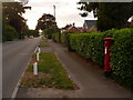
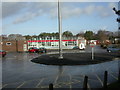
Ferndown: postbox № BH22 48, Church Road
This Elizabeth II-reign postbox is emptied at 4pm on weekdays and at 12:45pm on Saturdays – surprisingly the latest in the town on a Saturday, but nowhere near such on a weekday.
Image: © Chris Downer
Taken: 15 Jun 2009
0.15 miles
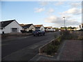
4
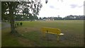
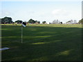
St George's Playing Field
This playing field is surrounded by schools, a leisure centre, sports and play facilities and further playing fields.
Image: © Paul Collins
Taken: 17 Jul 2016
0.17 miles
5
St George's Playing Field
This field lays at the heart of a zone of education, leisure and sports facilities.
Image: © Paul Collins
Taken: 17 Jul 2016
0.18 miles
6
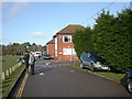
Ferndown Register Office
Off Peter Grant Way, overlooking Image; behind it, town council office. http://www.visionwebsites.co.uk/Contents/Misc/Details.asp?SiteId=651&SiteExtra=2981433&TopNavId=801&NavSideId=7901&MiscAreaId=732
Image: © Mike Faherty
Taken: 17 Jan 2010
0.21 miles
7
Ferndown Upper School
Off Cherry Grove. http://www.fernup.dorset.sch.uk/
Image: © Mike Faherty
Taken: 17 Jan 2010
0.22 miles
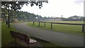
8
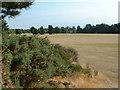
King George V Playing Field, Ferndown
View looking south
Image: © John Smitten
Taken: 22 Jul 2005
0.23 miles
9
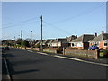
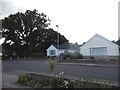
Ferndown, Westwood Avenue
Most of Ferndown's housing comprises bungalows, as here, to the North-east of the town centre.
Image: © Mike Faherty
Taken: 17 Jan 2010
0.24 miles
10
Ferndown, King George's Field
Off Church Road. Administered by a charity, and offering, apart from football, cricket, bowls & tennis; also with playground and skatepark. http://www.visionwebsites.co.uk/Contents/Text/Index.asp?SiteId=651&SiteExtra=2981433&TopNavId=798&NavSideId=8016
Image: © Mike Faherty
Taken: 17 Jan 2010
0.24 miles