
IMAGES TAKEN NEAR TO
Pompeys Lane, FERNDOWN, BH22 9DT
Introduction
This page details the photographs taken nearby to Pompeys Lane, BH22 9DT by members of the Geograph project.
The Geograph project started in 2005 with the aim of publishing, organising and preserving representative images for every square kilometre of Great Britain, Ireland and the Isle of Man.

There are currently over 7.5m images from over14,400 individuals and you can help contribute to the project by visiting https://www.geograph.org.uk
Image Map
Images are licensed for reuse under creativecommons.org/licenses/by-sa/2.0
Notes
- Clicking on the map will re-center to the selected point.
- The higher the marker number, the further away the image location is from the centre of the postcode.
Image Listing (20 Images Found)
Images are licensed for reuse under creativecommons.org/licenses/by-sa/2.0
Image
Details
Distance


3

Ferndown Common, tumulus
Bronze Age bowl barrow. http://www.pastscape.org.uk/hob.aspx?hob_id=457792&sort=2&rational=m&recordsperpage=10&maplat=50.79490879&maplong=-1.90279790&mapisa=1000&mapist=os&mapilo=-1.9028&mapila=50.7949&mapiloe=w&mapilan=n&mapios=SZ068995&mapigrn=99550&mapigre=406850&mapipc=#aRt
Image: © Mike Faherty
Taken: 28 Aug 2010
0.11 miles
4
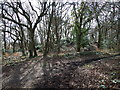
Tumulus, Ferndown Common
Although the tumulus is not named on the map, a nearby house is called Plover Barrow.
Image: © Lorraine and Keith Bowdler
Taken: 27 Mar 2010
0.11 miles
5

Ferndown Common, bridleway
Not shown on OS, but used by horses, as evidenced by hoofprints; perhaps not significant, as the common is open access land.
Image: © Mike Faherty
Taken: 28 Aug 2010
0.11 miles
6
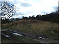
Tumulus, Ferndown Common
Image: © Lorraine and Keith Bowdler
Taken: 27 Mar 2010
0.12 miles
7

Longham, Pompey's Lane
Track/bridleway from Ringwood Road to Stapehill Road, passing through farm, grazing, heathland and nurseries.
Image: © Mike Faherty
Taken: 28 Aug 2010
0.15 miles
8

Ferndown Common
The southern side of the common is more open than the northern; scrub is controlled to maximise wildlife potential. http://www.herpconstrust.org.uk/reserves.htm
Image: © Mike Faherty
Taken: 28 Aug 2010
0.17 miles
9
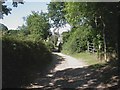
Longham, Angel Lane
Rough lane/bridleway from Ringwood Road to Pompey's Lane.
Image: © Mike Faherty
Taken: 28 Aug 2010
0.18 miles
10
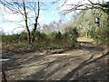
Sign post to Great Barrow, Ferndown Common
At the path junction, the broken sign post points straight ahead to The Great Barrow and to Ringwood Road behind us.
Image: © Lorraine and Keith Bowdler
Taken: 27 Mar 2010
0.20 miles