
IMAGES TAKEN NEAR TO
Elm Tree Walk, FERNDOWN, BH22 8TX
Introduction
This page details the photographs taken nearby to Elm Tree Walk, BH22 8TX by members of the Geograph project.
The Geograph project started in 2005 with the aim of publishing, organising and preserving representative images for every square kilometre of Great Britain, Ireland and the Isle of Man.

There are currently over 7.5m images from over14,400 individuals and you can help contribute to the project by visiting https://www.geograph.org.uk
Image Map
Images are licensed for reuse under creativecommons.org/licenses/by-sa/2.0
Notes
- Clicking on the map will re-center to the selected point.
- The higher the marker number, the further away the image location is from the centre of the postcode.
Image Listing (23 Images Found)
Images are licensed for reuse under creativecommons.org/licenses/by-sa/2.0
Image
Details
Distance
1
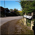
West Parley: Elm Tree Walk
Looking along this short road which starts along the back of the Parley Cross shops and then has a 90º corner to arrive here at Ridgeway. We glimpse one of the bungalows which are typical of the area.
The sign is an ordinary East Dorset District one from the 80s, mounted on original pyramid-topped stone posts from a previous sign, probably one of the Wimborne & Cranborne Rural District Council ones such as here: Image
This is photo no.130 of a series of 453 in my coronavirus lockdown walking project:
See https://www.geograph.org.uk/article/My-2020-Coronavirus-Lockdown-walking-project for the complete set of photos.
Image: © Chris Downer
Taken: 15 Apr 2020
0.03 miles
2
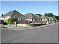
Bungalows on Elm Tree Walk
These are typical dwellings to the south of West Parley.
Image: © mike smith
Taken: 31 Jul 2007
0.04 miles
3
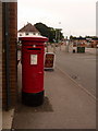
West Parley: postbox № BH22 25, New Road
This postbox stands outside Image and is emptied finally at 5:15pm on weekdays, and at noon on Saturdays. The white building behind it, on the other side of the crossroads, is the former premises of the post office; it moved into the convenience store here about 10 years ago.
Image: © Chris Downer
Taken: 8 Jun 2009
0.06 miles
4
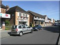
Shops at Parley Cross
This row of local shops on New Road, south of the cross roads, includes a chemist, kitchen and tiles shops, a co-op grocery store, and a fish & chip shop. Pretty good selection for the residents.
Image: © mike smith
Taken: 31 Jul 2007
0.06 miles
5
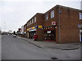
West Parley: Parley Cross Post Office
The post office at Parley Cross used to be on the northwest corner of the junction but about 10 years ago moved within the general store on the southwest corner, where we see it now.
Image: © Chris Downer
Taken: 1 Feb 2009
0.06 miles
6
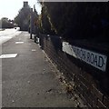
West Parley: Christchurch Road
Looking west from Parley Cross along this normally busy road, with a common name in this neck of the woods because, of course, Christchurch is a nearby town and several roads lead there. It is only a small segment of Christchurch Road which is within the 2km radius of my project, but we are outside the circle here as this is the nearest sign.
It is a modern East Dorset District Council sign featuring its logo at the left-hand end, which will become rarer as the years go by because in April 2019 East Dorset District Council was abolished and became part of the unitary Dorset Council.
This is photo no.71 of a series of 453 in my coronavirus lockdown walking project:
See https://www.geograph.org.uk/article/My-2020-Coronavirus-Lockdown-walking-project for the complete set of photos.
Image: © Chris Downer
Taken: 15 Apr 2020
0.07 miles
10
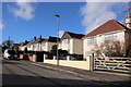
Houses in Longfield Drive
These smart detached houses are in a short residential cul-de-sac just off New Road the A347 , the main road running north through West Parley from Bournemouth
Image: © Nigel Mykura
Taken: 7 Feb 2019
0.08 miles