
IMAGES TAKEN NEAR TO
Greensome Drive, FERNDOWN, BH22 8BE
Introduction
This page details the photographs taken nearby to Greensome Drive, BH22 8BE by members of the Geograph project.
The Geograph project started in 2005 with the aim of publishing, organising and preserving representative images for every square kilometre of Great Britain, Ireland and the Isle of Man.

There are currently over 7.5m images from over14,400 individuals and you can help contribute to the project by visiting https://www.geograph.org.uk
Image Map
Images are licensed for reuse under creativecommons.org/licenses/by-sa/2.0
Notes
- Clicking on the map will re-center to the selected point.
- The higher the marker number, the further away the image location is from the centre of the postcode.
Image Listing (8 Images Found)
Images are licensed for reuse under creativecommons.org/licenses/by-sa/2.0
Image
Details
Distance
2
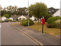
Ferndown: postbox № BH22 181, Greensome Drive
This postbox serves this little estate of desirable bungalows, each with arches in their design and few with a frontage wall or fence or hedge. The box is emptied at 5:15pm on weekdays and at 12:30pm on Saturdays.
Image: © Chris Downer
Taken: 8 Jun 2009
0.13 miles
4
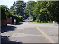
Golf Links Road, Ferndown but once an ancient trackway
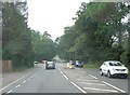
This view down Golf Links Road from its junction with the A347 (Ringwood Road, near Trickett's Cross) shows at first sight a fairly ordinary suburban highway disappearing into the distance; however its almost perfectly straight alignment betrays the fact that it was once an ancient trackway - traceable on 19th century maps - that led to Dudsbury Fort (or Dudsbury Camp), an early Iron Age fortification on the bank of the River Stour. In later centuries, it would almost certainly have been used by smugglers moving from the south coast inland to cross the heathland on their way to Cranborne and Salisbury.
Image: © Martin Rowley
Taken: 24 Jul 2012
0.23 miles
6
Ferndown: postbox № BH22 96, Turbary Road
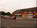
Turbary Road is the access road for a large housing estate which comprises a mix of council housing and desirable bungalows. Here, by the junction with the main road, are shops including a general store (round to the left), fish & chip shop, off licence and (out of picture, right) Chinese takeaway. The postbox, like the three in the estate, is emptied finally at 5:15pm on weekdays and at 12:30pm on Saturdays.
For many years residents of the estate campaigned for a post office, since it's quite a distance into Ferndown town from here – but they never got one.
Image: © Chris Downer
Taken: 8 Jun 2009
0.24 miles
7
Ferndown, Golf Links Road
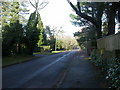
The northern end of this road is wider than further South (Image), and houses are larger; most have hedges and entryphones.
Image: © Mike Faherty
Taken: 17 Jan 2010
0.24 miles
8
Stream On Parley Common
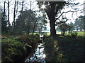
Looking towards Ferndown Golf Course.
Image: © Lorraine and Keith Bowdler
Taken: 11 Feb 2012
0.24 miles