
IMAGES TAKEN NEAR TO
Ameys Lane, FERNDOWN, BH22 8AY
Introduction
This page details the photographs taken nearby to Ameys Lane, BH22 8AY by members of the Geograph project.
The Geograph project started in 2005 with the aim of publishing, organising and preserving representative images for every square kilometre of Great Britain, Ireland and the Isle of Man.

There are currently over 7.5m images from over14,400 individuals and you can help contribute to the project by visiting https://www.geograph.org.uk
Image Map
Images are licensed for reuse under creativecommons.org/licenses/by-sa/2.0
Notes
- Clicking on the map will re-center to the selected point.
- The higher the marker number, the further away the image location is from the centre of the postcode.
Image Listing (26 Images Found)
Images are licensed for reuse under creativecommons.org/licenses/by-sa/2.0
Image
Details
Distance
1
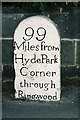
99 to London
It is peculiar that this milestone should specify "through Ringwood" – from here, no reasonable route could possibly avoid Ringwood (in the way that it would not be odd to state "through Winchester" as opposed to, say, Andover).
Image: © Chris Downer
Taken: Unknown
0.03 miles
2
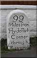
Old Milestone by the A31, Ringwood Road, Trickett's Cross
Carved stone post by the A31, in parish of FERNDOWN TOWN (EAST DORSET District), Ringwood Road, Ferndown; opposite Sainsbury's filling station, 20m East of roundabout, against bungalow wall, on South side of road. Dorset 2 (limestone), erected by the Ringwood, Longham & Leigh turnpike trust in the 19th century.
Inscription reads:-
99
Miles from
Hyde Park
Corner
through
Ringwood
Milestone Society National ID: DO_WBRW05.
Image: © J Tybjerg
Taken: 15 Jul 2002
0.06 miles
3
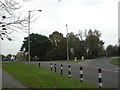
Trickett's Cross Roundabout
At the junction of Ringwood Road (A348) and Wimborne Road East.
Image: © Mike Faherty
Taken: 27 Nov 2010
0.06 miles
4
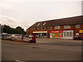
Ferndown: postbox № BH22 96, Turbary Road
Turbary Road is the access road for a large housing estate which comprises a mix of council housing and desirable bungalows. Here, by the junction with the main road, are shops including a general store (round to the left), fish & chip shop, off licence and (out of picture, right) Chinese takeaway. The postbox, like the three in the estate, is emptied finally at 5:15pm on weekdays and at 12:30pm on Saturdays.
For many years residents of the estate campaigned for a post office, since it's quite a distance into Ferndown town from here – but they never got one.
Image: © Chris Downer
Taken: 8 Jun 2009
0.07 miles
5
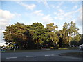
Roundabout at the end of Wimborne Road East
Image: © David Howard
Taken: 3 Jul 2017
0.07 miles
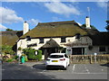
7
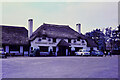
Smugglers Haunt, Trickett's Cross, Ferndown - mid 1960's
This image was taken by a family member during the school holidays of 1966. The pub then was owned by Brickwoods Ltd with the brewery being in Portsmouth. Brickwoods, along with 675 public houses was acquired by Whitbread Ltd in 1971. Brewing in Portsmouth ceased in 1983 and the brewery was demolished in 1990. The pub is still owned by Whitbreads and now trades under the Beefeater brand.
The slide was an Agfacolor which always seemed to have a blue/purple tinge, hence the poor colouring of this scanned image.
Image: © Mrs G. Reinholds (deceased)
Taken: Unknown
0.13 miles
8
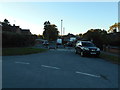
Early one morning
Ford Close, originally Ford Lane and a 'rat run'. Traffic calming measures now firmly in place.
Image: © Anthony Vosper
Taken: 28 Oct 2018
0.13 miles
9
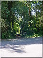
Old Trackway East Dorset
This is a view from the Wimborne Road near Trickett's Cross of the old trackway that once ran from Dudsbury hill fort on the River Stour, across the heathland of this part of Dorset and onto the hinterland of north Dorset and Wiltshire. It was undoubtedly used by smugglers for a time.
Image: © Martin Rowley
Taken: 24 Jul 2012
0.13 miles
10
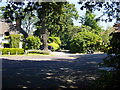
Old Trackway and 'Smugglers' Cottage, Trickett's Cross
A view of an ancient trackway that once ran from the banks of the River Stour (Dudsbury hill fort) across the heathland and on into north Dorset and Wiltshire. The cottage on the left of the lane is known as 'Smugglers Cottage', and parts of it are thought to be over 400 years old. The trackway was almost certainly used to take contraband away from the coastal area in the south to 'customers' inland. The road in the foreground is the Wimborne Road, once a turnpike linking that town with Ringwood.
Image: © Martin Rowley
Taken: 24 Jul 2012
0.14 miles