
IMAGES TAKEN NEAR TO
Woolslope Road, FERNDOWN, BH22 0PD
Introduction
This page details the photographs taken nearby to Woolslope Road, BH22 0PD by members of the Geograph project.
The Geograph project started in 2005 with the aim of publishing, organising and preserving representative images for every square kilometre of Great Britain, Ireland and the Isle of Man.

There are currently over 7.5m images from over14,400 individuals and you can help contribute to the project by visiting https://www.geograph.org.uk
Image Map
Images are licensed for reuse under creativecommons.org/licenses/by-sa/2.0
Notes
- Clicking on the map will re-center to the selected point.
- The higher the marker number, the further away the image location is from the centre of the postcode.
Image Listing (17 Images Found)
Images are licensed for reuse under creativecommons.org/licenses/by-sa/2.0
Image
Details
Distance
1
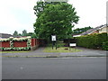
Footpath off of Woolslope Road, West Moors
This footpath leads down to a green, popular with dog walkers.
Image: © Lorraine and Keith Bowdler
Taken: 23 May 2011
0.04 miles
2
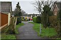
Path between houses in Canterbury Close
Leading from the Woolslope Farm open space.
Image: © David Martin
Taken: 10 Jan 2022
0.13 miles
3
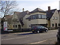
Fryer Mews, Woolslope Road
This image of Fryer Mews is from the junction of Woolslope Road with Pinehurst Road. The part of the building nearest the photographer form part of the flats (four), with the semi-detached & terraced house parts of the development running off to the left.
Image: © Martin Rowley
Taken: 12 Nov 2007
0.16 miles
4
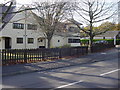
Fryer Mews, Pinehurst Road
The Fryer Mews development was built on the site of the old 'Fryer Arms' public house, which stood here from 1973 to 2005; this development, a mix of detached, semi-detached and terraced houses, plus four flats, was completed for occupation in late 2006. A decent view of the development can only be gained during the 'winter' part of the year as the trees in the front garden would, when in full leaf, significantly obscure the houses. In the background is the Roman Catholic Church of St. Anthony of Padua.
Image: © Martin Rowley
Taken: 12 Nov 2007
0.16 miles
5
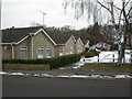
West Moors, Spinners Close
A close of modern, partially stone-clad bungalows, in a square mainly comprising rows of bungalows.
Image: © Mike Faherty
Taken: 10 Jan 2010
0.16 miles
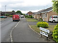
7
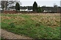
Pinehurst Park from Woolslope Farm
A park home site, although marked on the OS map as a caravan site.
Image: © David Martin
Taken: 10 Jan 2022
0.19 miles
8
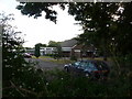
West Moors: Catholic church of St. Anthony of Padua
A modernish church on the corner of Pinehurst and Woolslope Roads.
Image: © Chris Downer
Taken: 15 Jun 2009
0.19 miles
9
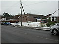
West Moors, chapel
Pinehurst Road Chapel, Evangelical, on Pinehurst Road. http://www.westmoorsdorset.co.uk/Pinehurst%20Chapel.htm
Image: © Mike Faherty
Taken: 10 Jan 2010
0.19 miles
10
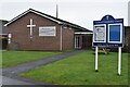
Pinehurst Community Church
With one of the most minimal church spires I have ever seen!
Image: © David Martin
Taken: 10 Jan 2022
0.19 miles