
IMAGES TAKEN NEAR TO
Newmans Lane, FERNDOWN, BH22 0LP
Introduction
This page details the photographs taken nearby to Newmans Lane, BH22 0LP by members of the Geograph project.
The Geograph project started in 2005 with the aim of publishing, organising and preserving representative images for every square kilometre of Great Britain, Ireland and the Isle of Man.

There are currently over 7.5m images from over14,400 individuals and you can help contribute to the project by visiting https://www.geograph.org.uk
Image Map
Images are licensed for reuse under creativecommons.org/licenses/by-sa/2.0
Notes
- Clicking on the map will re-center to the selected point.
- The higher the marker number, the further away the image location is from the centre of the postcode.
Image Listing (9 Images Found)
Images are licensed for reuse under creativecommons.org/licenses/by-sa/2.0
Image
Details
Distance
1

Footpath, Holt Heath
Part of National Trust walk number 12
Image: © Lorraine and Keith Bowdler
Taken: 5 May 2011
0.11 miles

3

Holt Heath, grassland
View across wet grassland on Holt Heath National Nature Reserve from Image towards Summerlug Hill. http://www.naturalengland.org.uk/ourwork/conservation/designatedareas/nnr/1006080.aspx
Image: © Mike Faherty
Taken: 2 Jan 2010
0.15 miles
4

West Moors, boardwalk
It is not clear from OS Explorer where the boundary between Holt and West Moors parishes lies, but this boardwalk is near enough to Newman's Lane, at the eastern side of the reserve, to call it in West Moors. The boardwalk gives access to Holt Heath National Nature Reserve, across wet grassland. http://www.naturalengland.org.uk/ourwork/conservation/designatedareas/nnr/1006080.aspx
Image: © Mike Faherty
Taken: 2 Jan 2010
0.15 miles
5

West Moors, Newman's Lane
Newman's Lane runs North from Image, then via a dog's leg East to Station Road; it is a private road, with public footpath.
Image: © Mike Faherty
Taken: 2 Jan 2010
0.15 miles

7
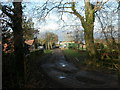
West Moors, farm buildings
Meadow Farm, off Newman's Lane.
Image: © Mike Faherty
Taken: 2 Jan 2010
0.19 miles
8
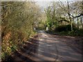
West Moors, bridge
Bridge with brick pillars and steel balustrades over Uddens Water on Newman's Lane.
Image: © Mike Faherty
Taken: 2 Jan 2010
0.25 miles
9
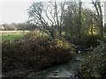
West Moors, Uddens Water
Uddens Water is a stream rising about 2km to the North-west, and joining Moors River near Palmer's Ford, 4km to the South-east. As seen looking downstream.
Image: © Mike Faherty
Taken: 2 Jan 2010
0.25 miles