
IMAGES TAKEN NEAR TO
Hardy Road, FERNDOWN, BH22 0EX
Introduction
This page details the photographs taken nearby to Hardy Road, BH22 0EX by members of the Geograph project.
The Geograph project started in 2005 with the aim of publishing, organising and preserving representative images for every square kilometre of Great Britain, Ireland and the Isle of Man.

There are currently over 7.5m images from over14,400 individuals and you can help contribute to the project by visiting https://www.geograph.org.uk
Image Map
Images are licensed for reuse under creativecommons.org/licenses/by-sa/2.0
Notes
- Clicking on the map will re-center to the selected point.
- The higher the marker number, the further away the image location is from the centre of the postcode.
Image Listing (11 Images Found)
Images are licensed for reuse under creativecommons.org/licenses/by-sa/2.0
Image
Details
Distance
1
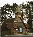
West Moors: church of St. John
The wooden church of St. John, West Moors, was demolished about 10 years ago after (I seem to recall) structural damage.
Image: © Chris Downer
Taken: Unknown
0.05 miles
2
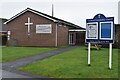
Pinehurst Community Church
With one of the most minimal church spires I have ever seen!
Image: © David Martin
Taken: 10 Jan 2022
0.12 miles
3
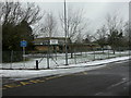
West Moors Middle School
At the junction of Elmhurst Road and Heathfield Way. http://www.westmoorsmid.dorset.sch.uk/
Image: © Mike Faherty
Taken: 10 Jan 2010
0.12 miles
4
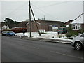
West Moors, chapel
Pinehurst Road Chapel, Evangelical, on Pinehurst Road. http://www.westmoorsdorset.co.uk/Pinehurst%20Chapel.htm
Image: © Mike Faherty
Taken: 10 Jan 2010
0.12 miles
5
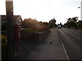
West Moors: postbox № BH22 159, Pinehurst Road
This little postbox, and the telegraph pole to which it is clasped, are supporting a large cobweb, full of flies, which is catching the sun ahead of the roof of Pinehurst Road Chapel. The box is emptied at 5pm on weekdays and at noon on Saturdays.
Image: © Chris Downer
Taken: 15 Jun 2009
0.12 miles
6
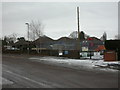
West Moors, first school
Oakhurst First School, on Shaftesbury Road; a cluster of single-storey buildings, with play equipment to the right. http://www.oakhurst.dorset.sch.uk/Our%20School/tour_our_school.htm
Image: © Mike Faherty
Taken: 10 Jan 2010
0.13 miles
8
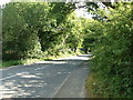
Station Road, West Moors
The B3072 road entering West Moors village from the south
Image: © John Smitten
Taken: 21 Jul 2005
0.17 miles
9
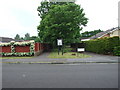
Footpath off of Woolslope Road, West Moors
This footpath leads down to a green, popular with dog walkers.
Image: © Lorraine and Keith Bowdler
Taken: 23 May 2011
0.23 miles
10
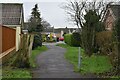
Path between houses in Canterbury Close
Leading from the Woolslope Farm open space.
Image: © David Martin
Taken: 10 Jan 2022
0.23 miles