
IMAGES TAKEN NEAR TO
Forest Road, FERNDOWN, BH22 0EU
Introduction
This page details the photographs taken nearby to Forest Road, BH22 0EU by members of the Geograph project.
The Geograph project started in 2005 with the aim of publishing, organising and preserving representative images for every square kilometre of Great Britain, Ireland and the Isle of Man.

There are currently over 7.5m images from over14,400 individuals and you can help contribute to the project by visiting https://www.geograph.org.uk
Image Map
Images are licensed for reuse under creativecommons.org/licenses/by-sa/2.0
Notes
- Clicking on the map will re-center to the selected point.
- The higher the marker number, the further away the image location is from the centre of the postcode.
Image Listing (11 Images Found)
Images are licensed for reuse under creativecommons.org/licenses/by-sa/2.0
Image
Details
Distance
1
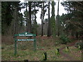
West Moors, forestry sign
At the western entrance to West Moors Plantation.
Image: © Mike Faherty
Taken: 31 Dec 2009
0.08 miles
2
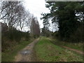
West Moors, trackbed
Trackbed of the old Southampton to Dorchester Railway, now part of the Castleman Trailway. http://www.dorsetforyou.com/castlemantrailway
Image: © Mike Faherty
Taken: 31 Dec 2009
0.14 miles
3

Castleman Trailway, northeast from West Moors
Path and cycle route on former railway trackbed.
Image: © David Martin
Taken: 10 Jan 2022
0.15 miles
4
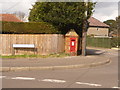
West Moors: postbox № BH22 105, Moorlands Road
This George V-reign postbox, set into an attractive little brick pillar, is emptied at 3:15pm on weekdays and at noon on Saturdays.
Image: © Chris Downer
Taken: 29 Mar 2009
0.15 miles
5
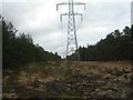
West Moors, power lines
Power lines from East Howe to Three Legged Cross, striding through West Moors Plantation.
Image: © Mike Faherty
Taken: 31 Dec 2009
0.15 miles
6
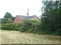
Old Railway post
Old railway post still standing in West Moors
Image: © Mat Tuck
Taken: 13 Jul 2014
0.17 miles
7
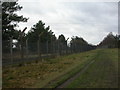
West Moors, MoD fence
Double barbed and mesh wire fence protecting the Defence Fuels Group depot. http://www.mod.uk/DefenceInternet/DefenceNews/EquipmentAndLogistics/FuellingTheFrontLine.htm
Image: © Mike Faherty
Taken: 31 Dec 2009
0.17 miles
8
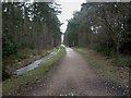
West Moors, forestry road
Main South to North road at the western end of the plantation. Note that snow has almost disappeared, but the ditch to the left remains frozen.
Image: © Mike Faherty
Taken: 10 Jan 2010
0.19 miles
9
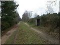
West Moors, platelayers' hut
On the Castleman Trailway, between West Moors and Ashley Heath.
Image: © Mike Faherty
Taken: 31 Dec 2009
0.19 miles
10
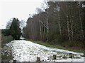
Westmoors Plantation
Only the western corner of the plantation is in this OS square; seen here, its southern boundary, birch with conifers behind. To the left, gardens of properties in Kingfisher Close. Note that the Forestry Commission's nearby sign states "Westmoors Plantation", while the area is West Moors.
Image: © Mike Faherty
Taken: 10 Jan 2010
0.19 miles