IMAGES TAKEN NEAR TO
Potterne Way, WIMBORNE, BH21 6RS
Introduction
This page details the photographs taken nearby to Potterne Way, BH21 6RS by members of the Geograph project.
The Geograph project started in 2005 with the aim of publishing, organising and preserving representative images for every square kilometre of Great Britain, Ireland and the Isle of Man.

There are currently over 7.5m images from over14,400 individuals and you can help contribute to the project by visiting https://www.geograph.org.uk
Image Map
Images are licensed for reuse under creativecommons.org/licenses/by-sa/2.0
Notes
- Clicking on the map will re-center to the selected point.
- The higher the marker number, the further away the image location is from the centre of the postcode.
Image Listing (12 Images Found)
Images are licensed for reuse under creativecommons.org/licenses/by-sa/2.0
Image
Details
Distance
1
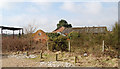
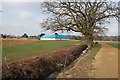
Potterne Farm, Verwood, Dorset
Now a ruin
Image: © Clive Perrin
Taken: 21 Feb 2009
0.01 miles
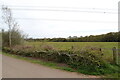
2
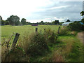
Potterne Park, Verwood
View of the sports field
Image: © John Smitten
Taken: 26 Aug 2005
0.03 miles
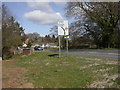
4
Bridleway In Potterne Park
Image: © Lorraine and Keith Bowdler
Taken: 12 Feb 2012
0.11 miles
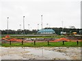
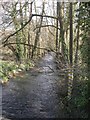
5
Sports centre, Potterne Park, Verwood, Dorset
This view from the footpath that runs from Potterne Park to Moors Valley Country Park.
Image: © Clive Perrin
Taken: 21 Feb 2009
0.11 miles
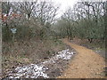
6
On the path to Moors Valley Country Park
A layered hedge
Image: © Clive Perrin
Taken: 6 May 2016
0.12 miles
7
Verwood, Crane Bridge
Bridge over the River Crane on Manor Road, South of Verwood. Brickwork to the left (South side) looks recent, and to the right (North) older. According to the 1938 OS, the river crossing here was by ford.
Image: © Mike Faherty
Taken: 22 Mar 2009
0.14 miles
8
Verwood, River Crane downstream
Seen from Manor Road bridge, the River Crane flowing downstream. For more information on this river with two names, http://www.dorsetlife.co.uk/articles/ArticlesDetail.asp?ID=565
Image: © Mike Faherty
Taken: 22 Mar 2009
0.14 miles
9
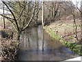
Verwood, River Crane upstream
The River Crane, seen from Manor Road bridge, looking upstream. For information on this river with two names, http://www.dorsetlife.co.uk/articles/ArticlesDetail.asp?ID=565
Image: © Mike Faherty
Taken: 22 Mar 2009
0.15 miles
10
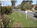
Verwood, molehills
Molehills on the verge alongside Manor Road, South of Verwood. For information on these mammals that work so hard, http://www.abdn.ac.uk/mammal/mole.shtml
Image: © Mike Faherty
Taken: 22 Mar 2009
0.16 miles