
IMAGES TAKEN NEAR TO
Chapel Lane, WIMBORNE, BH21 3SL
Introduction
This page details the photographs taken nearby to Chapel Lane, BH21 3SL by members of the Geograph project.
The Geograph project started in 2005 with the aim of publishing, organising and preserving representative images for every square kilometre of Great Britain, Ireland and the Isle of Man.

There are currently over 7.5m images from over14,400 individuals and you can help contribute to the project by visiting https://www.geograph.org.uk
Image Map
Images are licensed for reuse under creativecommons.org/licenses/by-sa/2.0
Notes
- Clicking on the map will re-center to the selected point.
- The higher the marker number, the further away the image location is from the centre of the postcode.
Image Listing (27 Images Found)
Images are licensed for reuse under creativecommons.org/licenses/by-sa/2.0
Image
Details
Distance
1
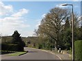
Chapel Lane, Corfe Mullen
A fine old oak, giving its name to a nearby house. The owner tells me the oak has a Tree Preservation Order.
Image: © John Palmer
Taken: 1 Apr 2009
0.01 miles
2
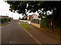
Corfe Mullen: postbox № BH21 192, Hillside Road
This postbox faces down Chapel Lane and is emptied finally at 4pm on weekdays and at 9am on Saturdays.
Image: © Chris Downer
Taken: 12 Jul 2009
0.07 miles
3
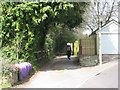
Chapel Close alley, Corfe Mullen
A footpath starts here and runs North to join up with Brook lane
Image: © John Palmer
Taken: 1 Apr 2009
0.07 miles
5
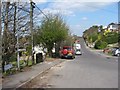
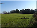
Hillside Road, Corfe Mullen
Here Corfe Mullen sweeps down to a green belt, giving a delightful view to the West
Image: © John Palmer
Taken: 1 Apr 2009
0.10 miles
6
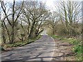
Waterloo Road
Peaceful under a warm winter sun. Trees and hedgerows are covered in buds
Image: © John Palmer
Taken: 1 Apr 2009
0.11 miles
7
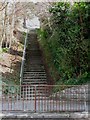
Corfe View Road steps, Corfe Mullen
In several parts of Corfe Mullen, steps allow pedestrians to get from a cul-de-sac to an adjoining road. Cars are not catered for!
Image: © John Palmer
Taken: 1 Apr 2009
0.12 miles
9
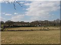
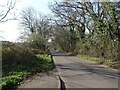
Little Manor Farm, Corfe Mullen
The green belt that, hopefully, guards the Western outskirts of Corfe Mullen. In the distance is Stony Down Plantation
Image: © John Palmer
Taken: 1 Apr 2009
0.14 miles
10
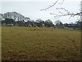
Corfe Mullen, sheep grazing
In a field off Waterloo Road, on the edge of the Green Belt; modern housing on Hillside Road in the distance.
Image: © Mike Faherty
Taken: 8 Jan 2012
0.14 miles