
IMAGES TAKEN NEAR TO
Wayground Road, WIMBORNE, BH21 3ED
Introduction
This page details the photographs taken nearby to Wayground Road, BH21 3ED by members of the Geograph project.
The Geograph project started in 2005 with the aim of publishing, organising and preserving representative images for every square kilometre of Great Britain, Ireland and the Isle of Man.

There are currently over 7.5m images from over14,400 individuals and you can help contribute to the project by visiting https://www.geograph.org.uk
Image Map
Images are licensed for reuse under creativecommons.org/licenses/by-sa/2.0
Notes
- Clicking on the map will re-center to the selected point.
- The higher the marker number, the further away the image location is from the centre of the postcode.
Image Listing (17 Images Found)
Images are licensed for reuse under creativecommons.org/licenses/by-sa/2.0
Image
Details
Distance
1
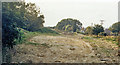
Site of Corfe Mullen Halt, Somerset & Dorset Joint line
View eastward, towards Broadstone, Poole and Bournemouth: ex-S&D Joint Bath - Templecombe - Bournemouth through line. This section round from Bailey Gate to Broadstone was a single-line loop at the southern extremity of the Joint Line, built to avoid reversal at Wimborne. The Halt was only built in July 1929 and was closed on 17/9/56, 9½ years before the end of the S&D on 7/3/66. The course of the railway can be seen, but no trace of the Halt.
Image: © Ben Brooksbank
Taken: 7 Oct 1986
0.07 miles
2
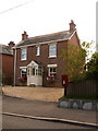
Corfe Mullen: postbox № BH21 78, Wimborne Road
There was a post office very nearby here – called East End – from 1934 until 17 November 1971. It may have been in the pictured building or next door to the right. The postbox is emptied finally at 5:15pm on weekdays and, late for Corfe Mullen, noon on Saturdays.
Image: © Chris Downer
Taken: 12 Jul 2009
0.11 miles
3
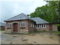
East End Methodist Church, Corfe Mullen: late May 2013
Image: © Basher Eyre
Taken: 28 May 2013
0.12 miles
4
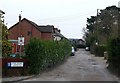
Pine Road leading to Happy Bottom
This is a track that leads from the B3078 at East End south west to Happy Bottom. It is an unmade road and is quite pot holed.
Image: © Nigel Mykura
Taken: 31 Jan 2010
0.13 miles
5
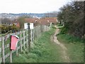
Near Stour View Gardens, Corfe Mullen
The footpath re-enters an area of small houses built in the last 15 years.
Image: © John Palmer
Taken: 30 Mar 2009
0.15 miles
6
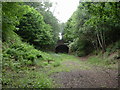
Lambs' Green, railway bridge
As seen from the trackbed of the former Poole to Dorchester railway; cutting, built up on the other side. The bridge serves road traffic to Wayground Road.
Image: © Mike Faherty
Taken: 19 Jun 2010
0.15 miles
7
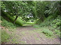
Lambs' Green, trackbed
On the Somerset & Dorset Joint Railway, track lifted 1969.
Image: © Mike Faherty
Taken: 19 Jun 2010
0.17 miles
8
Turf Zone "HappyBottom"
At Happy Bottom Nature Reserve.
Image: © Ian S
Taken: 17 Nov 2022
0.17 miles
9
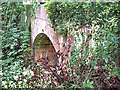
Bridge over the former Somerset and Dorset railway
The bridge carries Pine Road over the old S&D trackbed (closed 1966) to the east of the site of Corfe Mullen Halt (closed 1956).
Image: © David Spencer
Taken: 18 Jul 2005
0.20 miles
10
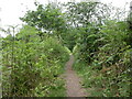
Lambs' Green, Wayman's Way
Alongside the former railway line from Poole to Dorchester; according to an information board, named after a local land owner and benefactor, Charle Wayman, 1927 to 2003.
Image: © Mike Faherty
Taken: 19 Jun 2010
0.20 miles