
IMAGES TAKEN NEAR TO
Wimborne Road, WIMBORNE, BH21 3DS
Introduction
This page details the photographs taken nearby to Wimborne Road, BH21 3DS by members of the Geograph project.
The Geograph project started in 2005 with the aim of publishing, organising and preserving representative images for every square kilometre of Great Britain, Ireland and the Isle of Man.

There are currently over 7.5m images from over14,400 individuals and you can help contribute to the project by visiting https://www.geograph.org.uk
Image Map
Images are licensed for reuse under creativecommons.org/licenses/by-sa/2.0
Notes
- Clicking on the map will re-center to the selected point.
- The higher the marker number, the further away the image location is from the centre of the postcode.
Image Listing (10 Images Found)
Images are licensed for reuse under creativecommons.org/licenses/by-sa/2.0
Image
Details
Distance
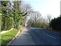
2

Old Direction Sign - Signpost by Wimborne Elms, Corfe Mullen parish
Annulus and bar finial - 3 arms; Dorset halo with NGR by the UC road, in parish of Corfe Mullen (East Dorset District), Cogdean Elms, junction of Wimborne Road with Higher Merley Lane.
Surveyed
Milestone Society National ID: DO_SY9997
Image: © M Faherty
Taken: 29 Aug 2007
0.08 miles
3
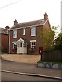
Corfe Mullen: postbox № BH21 78, Wimborne Road
There was a post office very nearby here – called East End – from 1934 until 17 November 1971. It may have been in the pictured building or next door to the right. The postbox is emptied finally at 5:15pm on weekdays and, late for Corfe Mullen, noon on Saturdays.
Image: © Chris Downer
Taken: 12 Jul 2009
0.08 miles
4
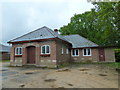
East End Methodist Church, Corfe Mullen: late May 2013
Image: © Basher Eyre
Taken: 28 May 2013
0.10 miles
5
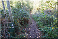
Turf Zone "HappyBottom"
At Happy Bottom Nature Reserve.
Image: © Ian S
Taken: 17 Nov 2022
0.14 miles
6
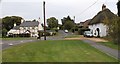
Cogdean Elms Junction. Corfe Mullen
Cottages at Wimborne Road - Higher Merley Lane junction at Corfe Mullen.
Image: © David Wright
Taken: 6 Nov 2009
0.15 miles
7
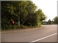
Corfe Mullen: postbox № BH21 215, Cogdean Way
This postbox serves a small estate that was built in the early 1990s. It is emptied finally at 4:45pm on weekdays and at 9am on Saturdays.
Image: © Chris Downer
Taken: 12 Jul 2009
0.15 miles
8
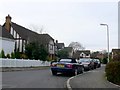
Cogdean Way
Cogdean Way is a modern residential street consisting of large detached houses one or two with swimming pools in their back gardens
Image: © Nigel Mykura
Taken: 31 Jan 2010
0.15 miles
9
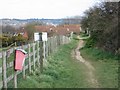
Near Stour View Gardens, Corfe Mullen
The footpath re-enters an area of small houses built in the last 15 years.
Image: © John Palmer
Taken: 30 Mar 2009
0.16 miles
10
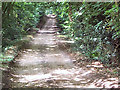
Roman Road between Corfe Mullen and Merley
The road runs roughly north-south to the west of Wimborne and Poole
Image: © David Spencer
Taken: 17 Jul 2005
0.19 miles