IMAGES TAKEN NEAR TO
St. Margarets Close, WIMBORNE, BH21 1NA
Introduction
This page details the photographs taken nearby to St. Margarets Close, BH21 1NA by members of the Geograph project.
The Geograph project started in 2005 with the aim of publishing, organising and preserving representative images for every square kilometre of Great Britain, Ireland and the Isle of Man.

There are currently over 7.5m images from over14,400 individuals and you can help contribute to the project by visiting https://www.geograph.org.uk
Image Map
Images are licensed for reuse under creativecommons.org/licenses/by-sa/2.0
Notes
- Clicking on the map will re-center to the selected point.
- The higher the marker number, the further away the image location is from the centre of the postcode.
Image Listing (30 Images Found)
Images are licensed for reuse under creativecommons.org/licenses/by-sa/2.0
Image
Details
Distance
1
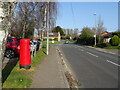
Victoria Road (B3082)
Showing position of Postbox No. BH21 151.
Image: © JThomas
Taken: 23 Mar 2022
0.04 miles
2
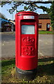
Elizabeth II postbox on Victoria Road
Postbox No. BH21 151.
Image: © JThomas
Taken: 23 Mar 2022
0.05 miles
3
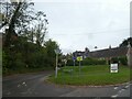
Cowgrove Road (NCN25) west of Wimborne Minster
Image: © David Smith
Taken: 30 Sep 2020
0.05 miles
4

No. 11 (of 12) the Green Plaques of Wimborne - Victoria Hospital
Location: on the wall of the Victorian building next to the modern Victoria Hospital on the B3082 Blandford road.
Image
Image: © Mike Searle
Taken: 22 Mar 2015
0.05 miles
5

Wimborne Minster: postbox № BH21 151, Victoria Road
This modern postbox stands outside the Victoria Hospital, and is emptied finally at 5pm on weekdays and at noon on Saturdays.
Image: © Chris Downer
Taken: 10 Jun 2009
0.05 miles
6
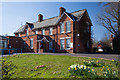
Wimborne - Victoria Hospital, the original building
The hospital was built in 1887 to commemorate Queen Victoria's Golden Jubilee. The land was owned by Sir John Hanham of Deans Court who leased it at a peppercorn rent on condition that the poor would be treated there. Many local people donated money towards the cost of the building including Sir Richard Glyn of the Gaunt's estate who gave £700. It opened initially with only thirty beds, and was limited to accepting local parishioners only, but as it grew, this was extended to outlying villages. It came under the authority of the NHS in 1947 when it ceased to be a voluntary hospital.
Image
Image: © Mike Searle
Taken: 22 Mar 2015
0.06 miles
7
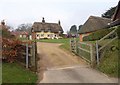
St Margaret's, Wimborne Minster
A C18 thatched cottage forming a terrace of three http://www.imagesofengland.org.uk/Details/Default.aspx?id=107294&mode=quick , part of the St Margaret's Almshouses - see also Image Seen from Cowgrove Road, along which run NCN25 and the parish boundary, so the almshouses are in Pamphill.
Image: © Derek Harper
Taken: 27 Jan 2010
0.06 miles
9
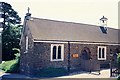
Pamphill: chapel of St. Margaret & St. Anthony
This little chapel is semi-detached to a small row of almshouses which replaced a mediaeval leper hospital. When I visited in about 1997, the current visitor book started in 1927! A charming little chapel, often driven past but not often noticed.
Image: © Chris Downer
Taken: Unknown
0.06 miles