IMAGES TAKEN NEAR TO
West Row, WIMBORNE, BH21 1LA
Introduction
This page details the photographs taken nearby to West Row, BH21 1LA by members of the Geograph project.
The Geograph project started in 2005 with the aim of publishing, organising and preserving representative images for every square kilometre of Great Britain, Ireland and the Isle of Man.

There are currently over 7.5m images from over14,400 individuals and you can help contribute to the project by visiting https://www.geograph.org.uk
Image Map
Images are licensed for reuse under creativecommons.org/licenses/by-sa/2.0
Notes
- Clicking on the map will re-center to the selected point.
- The higher the marker number, the further away the image location is from the centre of the postcode.
Image Listing (519 Images Found)
Images are licensed for reuse under creativecommons.org/licenses/by-sa/2.0
Image
Details
Distance
1
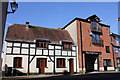
11A Mews Cottage, 11 and 10 West Row, Wimborne Minster
11 is Grade II Listed as West Row Studio Banks House a somewhat restored timber framed building of 17th century origin. Apparently now split into two cottages. The adjacent Old Malt House claiming to be from 1760 was converted to residential in the 1990s.
Image: © Jo and Steve Turner
Taken: 25 Feb 2019
0.00 miles
3
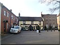
Wimborne, The White Hart
C17 pub on Cornmarket. Internally, central curving bar, with former public bar to right, with pool and games machines; three dining & drinking areas to left. Wooden panelling, beams, patio. Cask ales on offer at my visit: Ringwood Best, Fortyniner, Old Thumper. The building is listed by English Heritage: http://www.imagesofengland.org.uk/Details/Default.aspx?id=107038&mode=adv For some customer comments, see http://www.beerintheevening.com/pubs/s/24/24143/White_Hart_Inn/Wimborne
Image: © Mike Faherty
Taken: 31 Jan 2012
0.02 miles
4
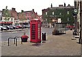
Wimborne: The Square
Early digital photo showing The Kings Head, Woolworths and Lloyds Bank
Image: © Mr Eugene Birchall
Taken: Unknown
0.02 miles
5
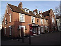
The Cornmarket, Wimborne
Shopping area and square on the north side of the historic Wimborne Minster Church.
http://www.wimborne.gov.uk/home/index.asp
Image: © Colin Smith
Taken: 13 Jan 2012
0.02 miles
6
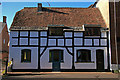
Banks House - Wimborne
English Heritage describe this C17 timber framed house rather sniffily as '..somewhat restored.' Neverthless it seems to have survived over three centuries fairly intact, despite the demolition that must have gone on around it over the years. Grade II Listed.
Image: © Mike Searle
Taken: 15 Nov 2007
0.02 miles
7
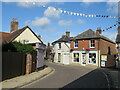
West Street, Wimborne
A double bend on West Street in the town of Wimborne Minster.
Image: © Malc McDonald
Taken: 21 Aug 2021
0.02 miles
8
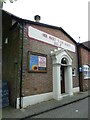
Salvation Army building near Wimborne Minster
Image: © Basher Eyre
Taken: 19 May 2012
0.02 miles
9
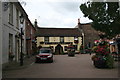
The White Hart, 6 Corn Market, Wimborne Minster
Grade II Listed Inn of 17th century origin altered in the 18th and 19th century, the front added in 1789. The White Hart had a licence in 1758 although the building, one of the oldest in Wimborne, dates back to 1648 and was originally used as the stabling for the Minster. It then became a holding place for the local constabulary, waiting for the Assizes. The cellar was originally used as an abattoir. The White Hart retains the post where each offender was secured awaiting his turn in the stocks that stood outside. Directory entries include, 1851 Maria Alexander, 1855 George P James, 1859 Edward Chilcott, 1875 Thomas Chissell (& farmer), 1889 Joseph Hutchings, 1895 Sidney Blanchard and 1911-1915 Mrs Ellen Guy.
Image: © Jo and Steve Turner
Taken: 3 Sep 2007
0.02 miles