
IMAGES TAKEN NEAR TO
Victoria Road, WIMBORNE, BH21 1EN
Introduction
This page details the photographs taken nearby to Victoria Road, BH21 1EN by members of the Geograph project.
The Geograph project started in 2005 with the aim of publishing, organising and preserving representative images for every square kilometre of Great Britain, Ireland and the Isle of Man.

There are currently over 7.5m images from over14,400 individuals and you can help contribute to the project by visiting https://www.geograph.org.uk
Image Map
Images are licensed for reuse under creativecommons.org/licenses/by-sa/2.0
Notes
- Clicking on the map will re-center to the selected point.
- The higher the marker number, the further away the image location is from the centre of the postcode.
Image Listing (195 Images Found)
Images are licensed for reuse under creativecommons.org/licenses/by-sa/2.0
Image
Details
Distance
2
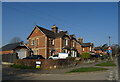
The end of Cuthbury Gardens, western edge of Wimborne Minster
Semi-detached house with detailing in the brickwork, including the garage
Image: © David Smith
Taken: 30 Sep 2020
0.06 miles
3
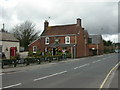
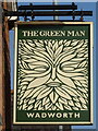
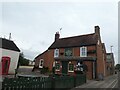
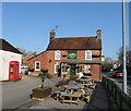
Wimborne, The Green Man
Cosy Wadworth pub on Victoria Road. Internally, central L-shaped bar, with drinking & eating areas to left, right & front. Cask ales on offer at my visit: 6X, Bishops Tipple, Henrys. For some customer comments, see http://www.beerintheevening.com/pubs/s/21/21095/Green_Man/Wimborne
Image: © Mike Faherty
Taken: 5 Apr 2010
0.08 miles
8
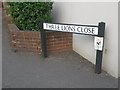
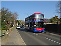
Wimborne Minster: ...but not close enough
Pictured about 10 minutes after kick-off of the World Cup semi-final between England and Croatia, which England would lose 2-1 after extra time.
Three Lions Close is a modern development of infill housing around the back of the pub on the corner of West Street and Victoria Road, currently called the Minster Arms. The name has nothing to do with the England football team: the pub was previously known as the Pudding and Pye, before that the Pye Corner (the name of the junction), and originally the Three Lions, hence the name of the close.
See Image for the pub in its Pudding & Pye guise (in 2012), and
Image when it was the Pye Corner (2007).
Image: © Chris Downer
Taken: 11 Jul 2018
0.10 miles
9
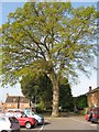
Ancient oak in car park
This fine tree is in Westfield Close car park, Wimborne, and is completely surrounded by tarmac. Its girth is 450 cms, indicating it was an acorn in the reign of Elizabeth I. Under good conditions, it would have another 450 years to live. But the tarmac prevents rain and nutrients getting to the roots, and will slowly choke the big tree. Just so people don't have far to walk to the shops.
Image: © John Palmer
Taken: 21 Apr 2009
0.11 miles
10
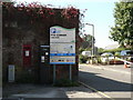
Wimborne Minster: postbox № BH21 6, Pye Corner
This George V-reign wall box is at Pye Corner, next to a small car park whose ticket machine is to its immediate right.
Image: © Chris Downer
Taken: 21 Sep 2008
0.11 miles