
IMAGES TAKEN NEAR TO
Jefferson Avenue, POOLE, BH15 4FN
Introduction
This page details the photographs taken nearby to Jefferson Avenue, BH15 4FN by members of the Geograph project.
The Geograph project started in 2005 with the aim of publishing, organising and preserving representative images for every square kilometre of Great Britain, Ireland and the Isle of Man.

There are currently over 7.5m images from over14,400 individuals and you can help contribute to the project by visiting https://www.geograph.org.uk
Image Map
Images are licensed for reuse under creativecommons.org/licenses/by-sa/2.0
Notes
- Clicking on the map will re-center to the selected point.
- The higher the marker number, the further away the image location is from the centre of the postcode.
Image Listing (157 Images Found)
Images are licensed for reuse under creativecommons.org/licenses/by-sa/2.0
Image
Details
Distance
1
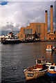
Poole Power Station, Hamworthy ca 1970
The old power station was demolished in 1993 and was operational from 1950-1984. Part of the site became the base on the Hamworthy side for the Twin Sails bridge that opened in 2012, providing a second road link from Poole town centre to Hamworthy.
Image: © Ronald Searle
Taken: Unknown
0.09 miles
2
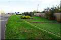
Turf Zone "Blandson"
On Jefferson Avenue, Lower Hamworthy, Poole.
Image: © Ian S
Taken: 17 Nov 2022
0.09 miles
3
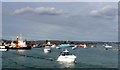
Poole Harbour
This is the view from the lift bridge towards the inner harbour showing the queue of boats that have been waiting for the bridge to lift so that they can leave the harbour. The bridge was raised five minutes previously and the boats have started to pass through. It took 15 minutes for all boats to pass through and the bridge to be lowered again.
Image: © Nigel Mykura
Taken: 15 Feb 2009
0.11 miles
4
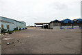
A large empty industrial site
Once a builder's merchant, now moved to Wareham.
Image: © John Lucas
Taken: 27 Apr 2022
0.12 miles
5
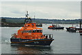
Lifeboats at Poole (4)
Alderney’s “Roy Barker I” leaves Hole Bay, for Poole Harbour.
On the date of my visit, there appeared to be a training exercise for several RNLI boats. The Lifeboat College is based at Poole. Poole’s lifeboat, “City of Sheffield” (Tyne Class, from 1982), was not involved, remaining on standby, outside Poole Lifeboat Station. Alderney’s “Roy Barker I” (Trent Class, from 1994) was in attendance, as were former Angle lifeboat “The Lady Rank” (Tyne Class 1982-2008), and Tyne Class training lifeboats “Ian and Anne Butler” and “Watchful”.
http://www.rnli.org.uk/
Image
Image: © Peter Trimming
Taken: 20 May 2010
0.12 miles
6
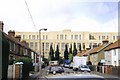
Hamworthy: Ivor Road skyline changes forever (part 2)
Looking down Ivor Road a few days after the Poole power station chimneys were demolished (see Image). The rest of the building was itself gradually demolished, and presently plans to replace the nearby lifting bridge with a structure that would accommodate the site continue.
Image: © Chris Downer
Taken: Unknown
0.12 miles
7
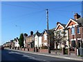
Blandford Rd Hamworthy
Very close to the docks and ferry port this road is one of the main thoroughfares of the port area. This is close to the junction with Ivor Rd.
Image: © Nigel Mykura
Taken: 28 Sep 2011
0.12 miles
8
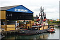
Moored in Back Water Channel, Poole, Dorset
In the link between Poole Harbour and Holes Bay, a tug is moored up beside a timber warehouse.
Image: © Peter Trimming
Taken: 20 May 2010
0.12 miles
9
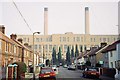
Hamworthy: Ivor Road skyline changes forever (part 1)
This was the view down Ivor Road before 2 February 1993, when the landmark chimneys of Poole power station were demolished. The view a few days later will be found here: Image
Image: © Chris Downer
Taken: Unknown
0.13 miles
10
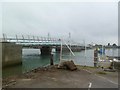
Poole, Twin Sails Bridge a)
Due for completion early 2012; seen from Marina Car Park. http://www.boroughofpoole.com/twinsails/
Image: © Mike Faherty
Taken: 24 Jan 2012
0.13 miles