
IMAGES TAKEN NEAR TO
Branksea Avenue, POOLE, BH15 4DW
Introduction
This page details the photographs taken nearby to Branksea Avenue, BH15 4DW by members of the Geograph project.
The Geograph project started in 2005 with the aim of publishing, organising and preserving representative images for every square kilometre of Great Britain, Ireland and the Isle of Man.

There are currently over 7.5m images from over14,400 individuals and you can help contribute to the project by visiting https://www.geograph.org.uk
Image Map
Images are licensed for reuse under creativecommons.org/licenses/by-sa/2.0
Notes
- Clicking on the map will re-center to the selected point.
- The higher the marker number, the further away the image location is from the centre of the postcode.
Image Listing (27 Images Found)
Images are licensed for reuse under creativecommons.org/licenses/by-sa/2.0
Image
Details
Distance
1
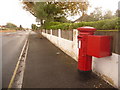
Hamworthy: postbox № BH15 179, Lulworth Avenue
This Elizabeth II-reign postbox is emptied finally at 5:30pm on weekdays and at 12:30pm on Saturdays.
Image: © Chris Downer
Taken: 15 Nov 2009
0.08 miles
2
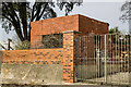
RAF Hamworthy - WW2 Pillbox (1)
-
Pillbox (Type FW3/26): EDoB ID: e48119
A type 26 pillbox overlooking the waterway with a large embrasure in the front that was probably for a mounted heavy machine gun (HMG).
This RAF Coastal Command base had in their fleet of flying boats Consolidated PBY Catalinas, and Short Sunderlands. The base was operational at Poole Harbour from 1939 - 1948, and was used also by the Royal Navy, the RAAF, and by BOAC (British Overseas Airways Corporation). Little remains today, and the land based area has become the scene of both commercial and military activity.
Image
Image: © Mike Searle
Taken: 1 Apr 2021
0.08 miles
3
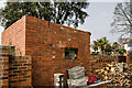
RAF Hamworthy - WW2 Pillbox (2)
-
Pillbox (Type FW3/26): EDoB ID: e48119
Side view with its single embrasure, with an identical arrangement on the opposite side.
Image
Image: © Mike Searle
Taken: 1 Apr 2021
0.08 miles
4
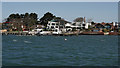
Houses at Lower Hamworthy
Seen from a cruise between Poole and Wareham. Property prices, at this location, are now starting to rival those at nearby Sandbanks.
Image: © Peter Trimming
Taken: 18 Apr 2015
0.10 miles
5
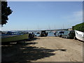
Lake, slipway
Public slipway off Lake Road.
Image: © Mike Faherty
Taken: 23 May 2010
0.10 miles
6
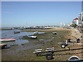
Lake, foreshore
As seen from Image; Moriconium Quay marina in front, housing to right.
Image: © Mike Faherty
Taken: 23 May 2010
0.12 miles
7
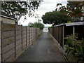
Hamworthy, footpath 13
From Branksea Avenue to Poole Harbour, at the end.
Image: © Mike Faherty
Taken: 22 Sep 2009
0.12 miles
8
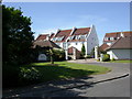
Moriconium Quay, entrance
Gated entrance to Image, on Lake Drive.
Image: © Mike Faherty
Taken: 23 May 2010
0.13 miles
9
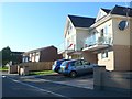
Houses in Lake Avenue
Many of the houses are built here to give views across the harbour from their balconies.
Image: © Nigel Mykura
Taken: 28 Sep 2011
0.14 miles
10
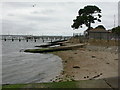
Hamworthy, slipways
Private slipways off Branksea Avenue.
Image: © Mike Faherty
Taken: 22 Sep 2009
0.14 miles