IMAGES TAKEN NEAR TO
School Lane, POOLE, BH15 3JR
Introduction
This page details the photographs taken nearby to School Lane, BH15 3JR by members of the Geograph project.
The Geograph project started in 2005 with the aim of publishing, organising and preserving representative images for every square kilometre of Great Britain, Ireland and the Isle of Man.

There are currently over 7.5m images from over14,400 individuals and you can help contribute to the project by visiting https://www.geograph.org.uk
Image Map
Images are licensed for reuse under creativecommons.org/licenses/by-sa/2.0
Notes
- Clicking on the map will re-center to the selected point.
- The higher the marker number, the further away the image location is from the centre of the postcode.
Image Listing (42 Images Found)
Images are licensed for reuse under creativecommons.org/licenses/by-sa/2.0
Image
Details
Distance
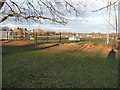
1
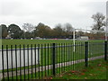
Poole Town FC
Currently sharing facilities with Oakdale South Road Middle School, Poole FC has applied to move to Branksome Recreation Ground, some 4km to the West, much to the consternation of some Branksome residents. http://www.poole.gov.uk/go.php?structureID=U46406b698b3ed&ref=N4A2F77A738F1D
Image: © Mike Faherty
Taken: 8 Nov 2009
0.05 miles
2
Turf Zone "PooleFootball"
Green off Stanley Green Road, Poole.
Image: © Ian S
Taken: 17 Nov 2022
0.06 miles
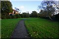
3
Stanley Green, recreation ground
Tatnam Farm Recreation Ground, off Stanley Green Road; Poole Town FC ground behind the bushes to the right.
Image: © Mike Faherty
Taken: 8 Nov 2009
0.10 miles
4
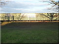
Poole : Poole Town FC
One of the stands of Poole Town Football Club taken from Stanley Green Road.
Image: © Lewis Clarke
Taken: 8 Mar 2010
0.11 miles
5
Poole : Poole Town Football Club
Nobody is playing football here at the moment, but come Saturday Poole will be out on the pitch.
Image: © Lewis Clarke
Taken: 8 Mar 2010
0.12 miles
6
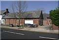
Tatnam Farm Buildings
These buildings, now in a residential area, are being converted into new homes.
Image: © mike smith
Taken: 9 Apr 2007
0.13 miles
7
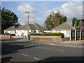
Sterte, bungalows
1930s-looking bungalows on Tatnam Road.
Image: © Mike Faherty
Taken: 29 Oct 2009
0.13 miles
8
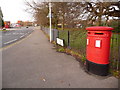
Sterte: postbox № BH15 295, Stanley Green Road
This Elizabeth II-reign postbox stands at the southern end of Stanley Green Road, at the junction of Tatnam and Sterte Roads. The left-hand slot is for stamped mail and the right-hand one for franked items. It is emptied finally at 5:30pm on weekdays, and on Saturdays has one of the latest collections at 1:15pm.
Image: © Chris Downer
Taken: 28 Dec 2009
0.13 miles
9
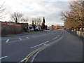
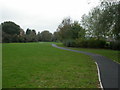
Poole : Stanley Green Road
Stanley Green Road leads to Fleets Lane. Poole FC are on the right.
Image: © Lewis Clarke
Taken: 8 Mar 2010
0.14 miles
10
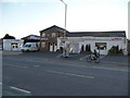
Poole : Shops on Stanley Green Road
Poole Yamaha Motorcycles and Poole Tyre Services based on Stanley Green Road.
Image: © Lewis Clarke
Taken: 8 Mar 2010
0.14 miles