IMAGES TAKEN NEAR TO
Lagland Street, POOLE, BH15 1QD
Introduction
This page details the photographs taken nearby to Lagland Street, BH15 1QD by members of the Geograph project.
The Geograph project started in 2005 with the aim of publishing, organising and preserving representative images for every square kilometre of Great Britain, Ireland and the Isle of Man.

There are currently over 7.5m images from over14,400 individuals and you can help contribute to the project by visiting https://www.geograph.org.uk
Image Map
Images are licensed for reuse under creativecommons.org/licenses/by-sa/2.0
Notes
- Clicking on the map will re-center to the selected point.
- The higher the marker number, the further away the image location is from the centre of the postcode.
Image Listing (295 Images Found)
Images are licensed for reuse under creativecommons.org/licenses/by-sa/2.0
Image
Details
Distance
1
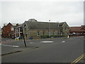
Poole Christian Fellowship
Evangelical church on Lagland Street, with a datestone of 1890, when it was built as a Brethren's Hall. http://www.poolechristianfellowship.org/
Image: © Mike Faherty
Taken: 4 Nov 2010
0.01 miles
2
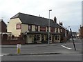
Poole: The Foundry Arms
This pub stands alongside the roundabout where North Street, Lagland Street and Newfoundland Drive meet.
Image: © Chris Downer
Taken: 2 Mar 2008
0.02 miles
3
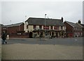
Poole, The Foundry Arms
Pub on Lagland Street. Internally, bar at back, eating and drinking areas to left, front and right; TV, music, games area (darts, pool), patio. Cask ales on offer at my visit: Ringwood Best, Fortyniner. For some customer comments, see http://www.beerintheevening.com/pubs/s/55/5509/Foundry/Poole
Image: © Mike Faherty
Taken: 4 Nov 2010
0.02 miles
4
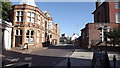
Lagland Street, Poole
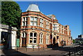
The building on the left was originally the town's main library, as the plaque on the wall makes clear.
Image: © John Welford
Taken: 11 Jul 2015
0.03 miles
5
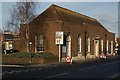
Former employment exchange, Lagland Street, Poole
Very typical inter-war or immediate post-war public service building in restrained neo-Georgian style design by an unknown architect in the Office of Works.
Image: © Jim Osley
Taken: 3 Jan 2017
0.04 miles
6
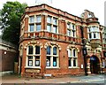
Wetherspoon pub, Lagland Street
Formerly a library and museum. There is an Ordnance Survey benchmark Image on the left hand end of the building's narrow face which also carries a plaque with an 1887 date.
Image: © phil Richards
Taken: 7 Aug 2021
0.04 miles
7
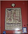
The Lord Wimborne, tiled plaque
A stylised street map of Poole Quay and High Street in Image, presumably dating from the building's use as town library. Carter's Poole Pottery existed from 1873 until closed after asset stripping in 2006. http://www.pooleroom.co.uk/index.php?main_page=page_2
Image: © Mike Faherty
Taken: 4 Nov 2010
0.04 miles
8

Inscription, former Poole Public Library
The former public library building has been converted into a public house.
Image: © Jim Osley
Taken: 31 Dec 2010
0.04 miles