
IMAGES TAKEN NEAR TO
Milton Close, POOLE, BH14 9QE
Introduction
This page details the photographs taken nearby to Milton Close, BH14 9QE by members of the Geograph project.
The Geograph project started in 2005 with the aim of publishing, organising and preserving representative images for every square kilometre of Great Britain, Ireland and the Isle of Man.

There are currently over 7.5m images from over14,400 individuals and you can help contribute to the project by visiting https://www.geograph.org.uk
Image Map
Images are licensed for reuse under creativecommons.org/licenses/by-sa/2.0
Notes
- Clicking on the map will re-center to the selected point.
- The higher the marker number, the further away the image location is from the centre of the postcode.
Image Listing (16 Images Found)
Images are licensed for reuse under creativecommons.org/licenses/by-sa/2.0
Image
Details
Distance
1
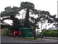
Parkstone: postbox № BH14 56, Spur Hill Avenue
An Edward VII-reign postbox under a large tree on the corner of Spur Hill Avenue and Munster Road, which we are looking down. It shares this corner plot with a bench and an electricity substation and is emptied finally at 5:30pm on weekdays and at noon on Saturdays.
The postbox has attached a drop box (see below) and there is a stand-alone one alongside too.
Image: © Chris Downer
Taken: 10 Jan 2009
0.12 miles
2
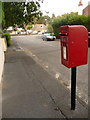
Parkstone: postbox № BH14 188, Glengariff Road
This little postbox receives its last collection at 5:30pm on weekdays and at noon on Saturdays. St. Osmund's Road is in the background.
Image: © Chris Downer
Taken: 9 Aug 2009
0.13 miles
3
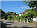
St. Osmund's Road, near Poole
St. Osmund's Road is a minor residential road near Poole.
Image: © Malc McDonald
Taken: 25 Aug 2021
0.17 miles
4
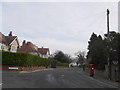
Parkstone: postbox № BH14 151, Clifton Road
A George V-reign box by the junction with King's Crescent, emptied finally at 5:30pm on weekdays and at noon on Saturdays.
Image: © Chris Downer
Taken: 10 Jan 2009
0.17 miles
6
Gleneagles Avenue, near Poole
Gleneagles Avenue is a minor residential road near Poole.
Image: © Malc McDonald
Taken: 25 Aug 2021
0.19 miles
7
Parkstone: postbox № BH14 130, St. Osmund?s Road
This Elizabeth II-reign postbox faces along Overbury Road, and is emptied finally at 5:30pm on weekdays and at noon on Saturdays. It has a drop box (see below) attached to it and another free-standing one alongside.
Image: © Chris Downer
Taken: 9 Aug 2009
0.20 miles
8
Caledon Rd Poole
View east along Caledon Rd which runs from Spur Hill Avenue to Kings Ave. Large detached houses in immaculate condition with immaculate cars outside next to immaculate lawns.
Image: © Nigel Mykura
Taken: 13 Jul 2010
0.21 miles
9
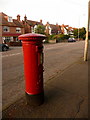
Parkstone: postbox № BH14 52, Penn Hill Avenue
An Edward VII-reign postbox, emptied finally at 5:30pm on weekdays and at noon on Saturdays.
Image: © Chris Downer
Taken: 9 Aug 2009
0.22 miles
10
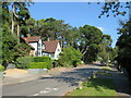
Links Road, near Poole
Links Road is a residential road near Poole. The road marking in the foreground indicates the route of National Cycle Network Route 25.
Image: © Malc McDonald
Taken: 25 Aug 2021
0.22 miles