1
Parkstone, chandlery
Force 4 Chandlery, on Bournemouth Road; with a datestone from 1909, and a partially legible "Warehouse" ghost sign. http://www.force4.co.uk/Article/118/Poole_Chandlery.html
Image: © Mike Faherty
Taken: 31 Dec 2011
0.01 miles
2
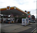
Filling station, Bournemouth Road
Now a Shell station, but formerly a Total station
Image
Image: © David Smith
Taken: 30 Mar 2017
0.02 miles
3
Bournemouth Road in east Parkstone
This is main route between Bournemouth and Poole.
Image: © mike smith
Taken: 1 Apr 2007
0.02 miles
4
Poole : Bournemouth Road A35
Looking along Bournemouth Road as it heads through Poole.
Image: © Lewis Clarke
Taken: 27 Mar 2018
0.03 miles
5
St Dunstan's Orthodox Church
This was originally "St Osmund's" but it has now been taken over by the Christian Orthodox Church, and renamed "St Dunstan's". See their web site at http://www.orthodoxpoole.org.uk/joomla/ for details.
Image: © mike smith
Taken: 1 Apr 2007
0.03 miles
6
The West Entrance to St Dunstan's Church
This church was originally "St Osmund's" but it has now been taken over by the Christian Orthodox Church, and renamed "St Dunstan's". See their web site at http://www.orthodoxpoole.org.uk/joomla/ for details.
Image: © mike smith
Taken: 1 Apr 2007
0.03 miles
7
Poole : St Dunstan's Orthodox Church
This church located on Bournemouth Road with a couple of bollards lighting the scene.
Image: © Lewis Clarke
Taken: 8 Mar 2010
0.03 miles
8
Parkstone: Romanian Orthodox church of St. Dunstan of Canterbury
This extraordinary building in Parkstone was built in 1913 as the parish church of St. Osmund, Parkstone. It remained so until the late 1990s when its closure was forced by structural unsoundness. It was even thought that the roof might collapse imminently. However, it has survived its battle and on 14 April 2005 it changed hands and became the Romanian Orthodox Church's first acquisition in the UK.
See more here: http://archive.bournemouthecho.co.uk/2001/5/16/101158.html , here: http://archive.bournemouthecho.co.uk/2004/5/22/66840.html , and here: http://archive.bournemouthecho.co.uk/2005/6/10/55067.html
Image: © Chris Downer
Taken: Unknown
0.04 miles
9
Church Junction
The junction next to St Dunstan's Church on the Bournemouth Road. This church was originally "St Osmund's" but it has now been taken over by the Christian Orthodox Church.
Image: © Gordon Griffiths
Taken: 1 Oct 2016
0.04 miles
10
Parkstone: postbox № BH14 38, Bournemouth Road
This large, modern postbox stands outside the Sainsbury's Local at 104-106 Bournemouth Road, which has opened fairly recently in premises which I seem to recall was a bed or furniture store previously – the Tesco Express diagonally now has some direct competition.
There was actually a post office nearby here – at 81 Bournemouth Road from 1908 to 1963 and then at number 131 until its closure on 31 May 1985. I'm sure this box would have moved with the office before ending up (or being replaced) here.
The postbox is emptied finally at 5:30pm on weekdays and at noon on Saturdays.
Image: © Chris Downer
Taken: 9 Aug 2009
0.04 miles


