
IMAGES TAKEN NEAR TO
Blake Dene Road, POOLE, BH14 8HF
Introduction
This page details the photographs taken nearby to Blake Dene Road, BH14 8HF by members of the Geograph project.
The Geograph project started in 2005 with the aim of publishing, organising and preserving representative images for every square kilometre of Great Britain, Ireland and the Isle of Man.

There are currently over 7.5m images from over14,400 individuals and you can help contribute to the project by visiting https://www.geograph.org.uk
Image Map
Images are licensed for reuse under creativecommons.org/licenses/by-sa/2.0
Notes
- Clicking on the map will re-center to the selected point.
- The higher the marker number, the further away the image location is from the centre of the postcode.
Image Listing (23 Images Found)
Images are licensed for reuse under creativecommons.org/licenses/by-sa/2.0
Image
Details
Distance
1
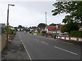
Austin Avenue Poole
Austin Avenue runs south from Elgin Rd to Blake Dene Rd. This is the view south from close to the junction with Elgin Rd.
Image: © Nigel Mykura
Taken: 13 Jul 2010
0.06 miles
2
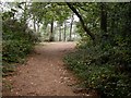
Parkstone, viewpoint
The top of Blake Hill, with a partial view over Poole Harbour; the hill is covered in mixed woodland.
Image: © Mike Faherty
Taken: 19 Sep 2009
0.09 miles
3
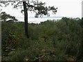
Parkstone, view
View from the top of Blake Hill, on a hazy day, across trees towards Poole Harbour, with Brownsea Island in the distance.
Image: © Mike Faherty
Taken: 19 Sep 2009
0.09 miles
4
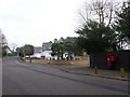
Parkstone: postbox № BH14 202, Elgin Road
This George VI-reign postbox is on the corner of Elgin Road and Austin Avenue and is emptied finally at 5:30pm on weekdays and at 11:45am on Saturdays.
Image: © Chris Downer
Taken: 10 Jan 2009
0.11 miles
5
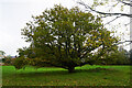
Turf Zone "BlakedaneTree"
Off Blake Dane Road, Poole.
Image: © Ian S
Taken: 16 Nov 2022
0.13 miles
6
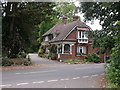
Parkstone Cemetery, lodge
Lodge at the eastern entrance on Pottery Road. http://www.poole.gov.uk/facilities/ref:F465e9bc76ca1f/aka:Parkstone+Cemetery/
Image: © Mike Faherty
Taken: 18 Sep 2009
0.14 miles
7
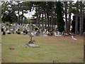
Parkstone Cemetery
Opened in 1894, in the Whitecliff area of Parkstone. http://www.tapperfuneralservice.co.uk/pdf/261PoolePDF.pdf
Image: © Mike Faherty
Taken: 18 Sep 2009
0.17 miles
8
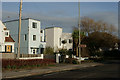
Houses on Sandbanks Road, Parkstone
Note the sign for Parkstone Yacht Club.
Image: © Peter Trimming
Taken: 22 Feb 2014
0.18 miles
9
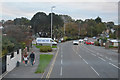
Poole : Sandbanks Road B3369
Looking along Sandbanks Road.
Image: © Lewis Clarke
Taken: 28 Oct 2017
0.18 miles
10
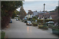
Poole : Elgin Road
A residential road in Poole.
Image: © Lewis Clarke
Taken: 28 Oct 2017
0.19 miles